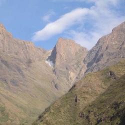
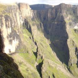
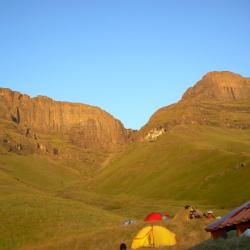
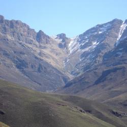
An index of passes in the Central Drakensberg of KwaZulu-Natal.

Pass

[1]    [2]    [3]    [4]

Height

[5]

Co-ordinate

(WGS84)   

[6]

Difficulty rating

1-10

 [7]

Key aspects

[8]

Used by locals

[9]

GPS data
Photo
Gray's Pass


3105 m


S29° 04.296

E29° 19.386
 4  
  • major trail
  • sustained
  • rocky gully at top
  • bushy at bottom/approach
  • short scramble
  • traverse of interest
major  gpx Grays Pass
Cowl Pass   
2955 m
 
S29° 04.833
E29° 20.869
 7
  • no trail
  • sustained
  • route finding challenge
  • not on escarpment
  • caution advised
  • rocky gully
  • short scramble(s)
no   Monks Cowl
Keartland's Pass  
2045 m
 
S29° 03.979
E29° 22.622
   
  • major trail
  • Little Berg
   gpx  
Ships Prow North Pass (Cathkin Mountain Pass)  
3305 m
 
S29° 05.781
E29° 19.559
   
  • no trail
  • sustained
  • caution advised
  • rocky gully
  • loose scree slope
  • route finding challenge
  • bushy at bottom/approach
no  gpx Ships Prow Pass
Ship's Prow South Pass  

3285 m

 
S29° 05.988
E29° 19.539
 9  
  • no trail in places
  • sustained
  • steep grassy slopes
  • bushy at bottom/approach
minor  gpx Ships Prow
van Heyningen's Pass  
1815 m
 
S29° 06.332
E29° 26.243
   
  • trail
  • Little Berg
   gpx  
Old Woman Pass   
3005 m
 
S29° 07.937
E29° 21.257
   
  • no trail
  • sustained
  • caution advised
  • rocky gully
  • short scramble(s)
  • route finding challenge
  • bushy at bottom/approach
  • source of confusion
unlikely   Injasuthi views
Apes Pass (SG maps version)  
2985 m
 
S29° 08.249
E29° 21.245
 7  
  • no trail
  • caution advised
  • rocky gully
  • short scramble(s)
unlikely  gpx  
Leslie's Pass  
3075 m
 
S29° 09.210
E29° 20.637
 6  
  • trail
  • steep grassy slopes
  • rocky slopes
unlikely  gpx  
Injisuthi Pass  
3225 m
 
S29° 10.552
E29° 20.785
   
  • no trail
  • caution advised
  • rocky gully
  • short scramble(s)
  • sustained
  • climbing gear/rope required
  • route finding challenge
  • bushy at bottom/approach
no  gpx Injasuthi Pass
Rowsell's Pass  3145 m

S29° 10.676

E29° 21.513

   
  • no trail
  • caution advised
  • boulder bed approach
  • steep grassy slopes
  • sustained
  • route finding challenge
  • climbing gear/rope required
  • bushy at bottom/approach
no    
Hilton Pass  
3140 m
 
S29° 10.855
E29° 21.342
   
  • no trail
  • caution advised
  • boulder bed approach
  • steep grassy slopes
  • sustained
  • route finding challenge
no  gpx Hilton Pass
Corner Pass (Northern High Approach)  
3155 m
 
S29° 12.760
E29° 24.471
 5  
  • trail on NHA
  • no trail on pass
  • short scramble(s)
  • rocky gully
yes  gpx  
Corner Pass (gully)  
3155 m
 
S29° 12.760
E29° 24.471
 5  
  • no trail
  • short scramble(s)
  • rocky gully
unlikely  gpx Corner Pass
Around the Corner Pass   
3110 m
 
S29° 13.078
E29° 24.673
 5  
  • trail
  • steep grassy slopes
  • rocky slopes
  • short exposed scramble(s)
yes gpx   
Judge Pass  
3135 m
 
S29° 13.347
E29° 24.629
 4  
  • major trail
  • traverse of interest
major  gpx Judge Pass
Gypaetus Pass   
3060 m
 
S29° 15.156
E29° 25.414
 4  
  • no trail
  • steep grassy slopes
  • sustained
  • route finding challenge
no  gpx  
Bannerman Pass  
3085 m
 
S29° 15.195
E29° 25.192
 3  
  • trail
  • steep grassy slopes
  • rocky gully
yes gpx  Bannermans Pass
Thumb Pass   
3030 m
 
S29° 16.465
E29° 26.431
 4  
  • no trail
  • steep grassy slopes
  • short scramble(s)
  • route finding challenge

unlikely

 gpx The Thumb
Hlubi Pass (North)   
2990 m
 
S29° 16.603
E29° 26.353
 4  
  • no trail
  • short scramble(s)
  • grassy slopes
  • gully

unlikely

 gpx Giants Castle - 06 June 2010
Hlubi Pass (South)   
2990 m
 
S29° 16.633
E29° 26.358
 4  
  • no trail
  • grassy slopes
  • gully

unlikely

 gpx Giants Castle - 06 June 2010
Langalibalele Pass  
2920 m
 
S29° 16.753
E29° 26.137
 2  
  • trail
  • grassy slopes
major  gpx Giants Castle - 06 June 2010
Bond Pass   
3060 m
 
S29° 17.588
E29° 26.384
 5  
  • no trail
  • steep grassy slopes
  • short scramble(s)
  • route finding challenge
no  gpx  
Jarateng Pass North   

3115 m

 
S29° 18.139
E29° 26.475
 4  
  • no trail
  • grassy slopes
  • rocky gully
  • bushy at bottom/approach
unlikely  gpx  
Jarateng Pass Middle  
3175 m
 
S29° 18.578
E29° 26.287
 3  
  • no trail
  • grassy slopes
  • bushy at bottom/approach
minor  gpx  
Jarateng Pass South   
3140 m
 
S29° 18.870
E29° 26.482
 3  
  • no trail
  • grassy slopes
  • bushy at bottom/approach
unlikely  gpx  
Katana Pass   
3025 m
 
S29° 19.393
E29° 27.087
 4  
  • no trail
  • steep grassy slopes
  • rocky gully
  • traverse of interest
  • short scramble(s)
unlikely  gpx  


Giant's Castle Pass West variation


3195 m
S29° 20.787
E29° 27.621
     no    
Giant's Castle Pass  
3110 m
 
S29° 20.919
E29° 27.864
 5  
  • trail
  • steep grassy slopes
yes  gpx  
Giant's Castle Eastern Gully  
3275 m
 
S29° 20.819
E29° 28.924
   
  • no trail
  • climbing gear/rope required
  • route finding challenge
  • caution advised
no    
Elandshoek Pass   
3120 m
 
S29° 21.114
E29° 28.804
 5  
  • trail
  • grassy slopes
  • short scramble(s)
yes  gpx  
Taylor's Pass  
2365 m
 
S29° 23.000
E29° 31.922
   
  • trail
  • grassy slopes
  • Little Berg
  • trail is disappearing due to reduced use by locals
minor  gpx  
Lotheni Pass North Fork  
2950 m
 
S29° 21.709
E29° 26.739
   
  • no trail
  • steep grassy slopes
  • short scramble(s)
  • exposed
  • route finding challenge
  • caution advised
no   Cattle Rustling on Lotheni Pass
 
2940 m
 
S29° 21.787
E29° 26.676
 4  
  • no trail in places
  • steep grassy slopes
  • very bushy at bottom/approach
  • trail on pass is disappearing due to reduced use by locals
minor  gpx

Cattle Rustling on Lotheni Pass

(main access) 
2920 m
 
 
S29° 21.882
E29° 26.760
 4  
  • no trail in places
  • steep grassy slopes
  • very bushy at bottom/approach
  • trail on pass is disappearing due to reduced use by locals
minor  gpx

Cattle Rustling on Lotheni Pass

eNtubeni Pass  
2900 m
 
S29° 22.088
E29° 26.970
 4  
  • no trail in places
  • grassy slopes
  • very bushy at bottom/approach
unlikely  gpx  
Uklebe Pass   
3000 m
 
S29° 23.733
E29° 25.782
 5  
  • no trail
  • steep grassy slopes
  • short scramble(s)
  • route finding challenge
unlikely    
Ka Masihlenga Pass  
3195 m
 
S29° 23.867
E29° 25.145
 5  
  • no trail
  • steep grassy slopes
  • boulder bed approach
  • short scramble(s)
  • route finding challenge
minor  gpx ka Masihlenga Pass
Redi Pass  
2985 m
 
S29° 25.514
E29° 26.036
 4  
  • no trail
  • steep grassy slopes
  • short scramble(s)
  • route finding challenge
unlikely  gpx  
Buttress Pass - The Passage  
2925 m
 
S29° 25.979
E29° 25.489
 4  
  • no trail
  • steep grassy slopes
  • rocky gully
  • short scramble(s)
unlikely  gpx Buttress pass (The passage)
Hlatimba Pass North  
2885 m
 
S29° 26.023
E29° 24.333
 4  
  • no trail in places
  • steep grassy slopes
minor  gpx Hlatimba Pass
Hlatimba Pass South  
2845 m
 
S29° 26.163
E29° 24.018
 3  
  • trail
  • grassy slopes
  • gully
major  gpx Hlatimbe pass - South

Mlahlangubo Pass (Hlatimba Valley) 

 
2890 m
 
S29° 27.120
E29° 23.448
 3  
  • no trail in places
  • grassy slopes
  • approach on ridge above Hlatimba valley
yes    
Mlahlangubo Pass (gully)  
2910 m
 
S29° 27.134
E29° 23.282
 3  
  • no trail in places
  • grassy slopes
minor  gpx  


Ntsupenyana Pass


2810 m
 
S29° 27.835
E29° 22.254
5  
  • no trail
  • steep grassy slopes
  • rocky gully
 unlikely    
Ngaqamadolo Pass North  
2830 m
 
S29° 27.874
E29° 22.113
 5  
  • no trail
  • grassy slopes
  • rocky gully
unlikely    
Ngaqamadolo Pass South  
2900 m
 
S29° 28.078
E29° 21.975
 5  
  • trail
  • grassy slopes
  • traverse of interest
yes    
Dyke Pass
2980 m
S29° 27.997
E29° 20.563
     unlikely    
Mkhomazi Pass  
2870 m
 
S29° 28.702
E29° 19.171
 4  
  • trail
  • grassy slopes
  • gully
major  gpx  
Mohlesi Pass  
3165 m
 
S29° 29.023
E29° 18.310
 6  
  • no trail
  • steep grassy slopes
  • rocky gully
  • short scramble(s)
  • sustained
unlikely    
Nhlangeni Pass  
3225 m
 
S29° 29.428
E29° 17.565
 5  
  • no trail
  • grassy slopes
  • rocky gully
unlikely   Nhlangeni Pass
ka-Ntuba Pass  
3310 m
 
S29° 31.203
E29° 17.787
 6  
  • no trail
  • steep grassy slopes
  • rocky gully
  • sustained
minor  gpx kaNtuba Pass
Twin Peak Pass          yes    
Mangaun Pass  
3035 m
 
S29° 32.498
E29° 18.807
 6  
  • no trail
  • grassy slopes
  • traverse of interest
  • route finding challenge
no  gpx  
Ntshintshini Pass  
3120 m
 
S29° 32.860
E29° 18.502
 7  
  • no trail
  • grassy slopes
  • route finding challenge
  • rocky gully
  • short exposed scramble(s)
  • caution advised
unlikely    
Mqatsheni Pass  
3200 m
 
S29° 33.304
E29° 18.682
 7  
  • no trail
  • grassy slopes
  • rocky gully
  • short scramble(s)
unlikely    
Mqatsheni South Pass
3020 m
S29° 33.947
E29° 19.267
     unlikely    
Phinong Pass  
2935 m
 
S29° 34.501
E29° 19.556
 4  
  • trail
  • grassy slopes
  • rocky gully
  • short scramble(s)
Yes    

Notes

1. By Drakensberg standards the majority of passes are those which provide access to the escarpment, and this is naturally where much of the interest by hikers lies. Some trails that provide access to the Little Berg plateau have been designated the status of "pass" in the names that were given to them. This list simply honours that historical designation, and no attempt it made in determining whether other trails that provide access to the Little Berg should be given the same designation. Some passes provide passage over a range, but not to the escarpment. These are included in this list on a case-by-case basis that is mainly driven available documentation provided by those who explore these options. Finally, some unusual routes, such as ones that link up the summits of two different passes via a traverse are also included here on a case-by-case basis.


2. Some passes can be considered classic in the sense that they offer a good, recommended route that has a well-worn trail. Other passes may have less of a trail, or no trail at all, but may still be good options for reasonably fit and competent hikers. Some routes are very adventurous, often being strenuous, crossing difficult terrain, and with challenging route-finding. Certain routes may even be described as "technical". This list, in seeking to be comprehensive, lists all of the above. It could be argued that some routes listed here are actually mountaineering routes and should not be referred to as a "pass". Several routes listed here could land a party up in serious trouble if they are ill-prepared or if they have wrongly assessed their own competency. The reader is asked to use the information presented here with caution and sober assessment.


3. Passes may have more than one route leading to the same summit point. Others have routes that converge well below the summit. On the other hand there are passes that are considered distinct from each other yet share common approaches, while others are described as variations of a main route. While attempting to draw attention to what options are available to hikers, this list currently does not follow strict definitions in how these distinctions are made.


4. The names provided have a variety of origins and should by no means be considered final or official. While many names used here are well established and documented in classic Drakensberg literature and maps, there are a significant amount that have arisen in more recent times. Many have been put forward and utilised by hikers who are active on Vertical Endeavour's forum (or who at least follow the forum). There is currently no system for documenting these origins. There is also no framework or set of guidelines whereby such names can be proposed, researched, ratified or even revised. There may be other names in use that could be more appropriate - even among hikers different names may be used. Even in the absence of alternate names, the ones put forward may not always be the most appropriate ones.


5. Heights are drawn from maps wherever possible, and in some cases from literature. In the absence of these, the heights are drawn from hand-held GPS readings, which may not be accurate. Currently there is no system for indicating where the figure comes from. Figures may be adjusted from time to time.


6. These co-ordinates are recorded using hand-held GPS devices and thus may be subject to a degree of inaccuracy. Likewise, using this data across different devices will also result in some variance.


7. The difficulty grading system is developed and maintained by Stijn Laenen, Jonathan Newman and Tony Marshall on a voluntary basis. Effort is made to maintain accuracy and eliminate bias but readers are reminded that any sort of grading system is subject to interpretation and opinion. One person's experience on a pass will differ from another due to a variety of reasons. The ratings are a comparison of Berg passes relative to each other - always bear in mind that all Berg passes should be considered challenging hikes in a mountainous environment. A good level of fitness, resilliance and competency is required for any Berg pass. While aimed at being a useful guide, remember that the authors cannot be held responsible for the way this information is used, nor for any adverse outcomes resulting from decisions which were made using this information.


8. Keywords are used to convey important ascepts about each pass in a succinct manner. They help paint a picture of what a pass may be like with the limitation that they may not always convey the entire picture. This feature is in a beta phase and is subject to frequent updates and corrections.


9. "Locals" here refers to other people who make use of these passes apart from hikers. They may be from South Africa or Lesotho and can include smugglers, rustlers, herdsmen, traders and migrant workers. The knowledge of which passes are used by them, and to what extent, helps create a realistic picture for hikers to know what to expect when exploring these mountains. This is particularly relevant for helping hikers make informed decisions to reduce their risk to crime. For example it is generally a good precaution to try not overnight directly on busy trails as much as possible. However, just because a pass is used heavily by locals does not necessarily mean that incidents are taking place there. The security-related discussions on our forum keep track of the "where", "what" and "why" of these incidents. Vertical Endeavour seeks to portray an accurate and honest picture of what is going on in the Berg - not to frighten people away but rather to help them make good decisions to reduce the risk of problems.


10. This page is always being updated, edited and improved as more or better information becomes available. Those who have contributed to the maintenance of this information include Chris Sommer, Merv Gavin, Andrew Porter and Tony Marshall.

Log in to comment