Ifidi and Icidi passes are infamous for being two of the most difficult passes that the Berg has to offer. Don't let this put you off though. With enough experience and fitness, Ifidi is one of the most satisfying Berg passes to tackle with 400 vertical metres of a narrow rock gully to negotiate before topping out on the slopes of Thaba Ndanyazana.

This gully does pose some potential problems as we got stuck on a ledge for 3 hours during a flash flood after an ordinary summer thunderstorm. If choosing between Ifidi and Icidi, go with Ifidi as its route is relatively simple to navigate and far less frustrating bundu-bashing needs to be done.

Area:
Mweni, Northern Drakensberg

Rating:
Rock   * * * *   9/10
Difficulty of the pass is rated from 1-10 (10 being very difficult, only to be attempted by the fit and experienced). A subjective quality rating is indicated by the number of stars (1 being low, 5 being the highest). Factors such as scenic beauty and overall experience come into play here, which may differ from person to person.

Access:
Ifidi Pass can be accessed by a 16km walk-in through all the kraals from the Mnweni Cultural Centre. The Ifidi river valley branches off right from the Mnweni river valley when the main river is crossed about 6 km from the CC.

Details:
The distance from Cycad Cave to the top of Ifidi Pass is 5 km with an altitude gain of 1150m.

Route:
There is a clear, dagga-smuggler's path all the way to Cycad Cave just before the small patch of indigenous forest. The path continues down to the river through the forest and dies shortly afterwards in the boulder bed of the Ifidi River. The route is fairly simple from here - just stick to the river, boulder-hopping all the way up. At about 2300m, the boulders get too large to clamber over. We bypassed this section of the river by climbing up the steep, vegetated slopes on the southern (left) slopes of the pass. Stay above the river on these slopes all the way to a major fork in the river at the base of the impressive Ifidi Pinnacles. Be sure to take the right-hand fork here and head into the narrowing rock gully at 2600m. This gully eventually narrows to about 4m wide and its gradient rears up steeply. The rest of the pass involves scrambling up the boulders in this gully. Most of it only involves some large step-ups but there are 3 sections where packs may need to be passed up to negotiate the 4m chimneys. After loads of fun in the gully, the gradient eases off again and you will find yourself on the final 20m of grassy slopes to the summit at 3000m.

Finding the pass from the top:
The first gully South of Thaba Ndanyazana which has a small cairn near the top is Ifidi Pass. It looks really intimidating from the escarpment so make sure you have the correct gully!
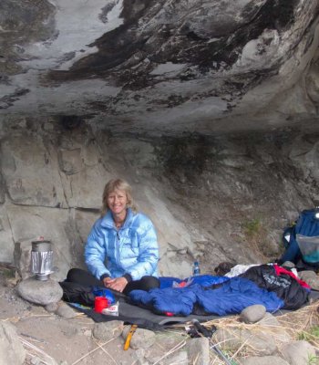
Overnight Spots:
Cycad Cave has a perfect location at the base of the bass at about 1850m. This cave is, however, very dirty with the entire roof covered with black soot and a thick layer of ash on the ground. There are quite a few spots to camp on the grassy slopes below the cave near the river and all the way up to about 2200m up the pass, it is possible to find a reasonable camping spot of the banks of the river too. There is apparently a really small shelter at the top of the pass called Ifidi Cave but most people don't bother with it.

Water:
The Ifidi River has running water until the point where the boulders become house-sized (in Summer). There is also a small, seasonal trickle in the final gully itself and a large river on top, about 500m from the pass summit.


Forum Topic:

More info on Ifidi Pass can be found on the forum, here:

http://www.vertical-endeavour.com/forum/11-drakensberg-passes/4161-ifidi-pass.html?limit=6&start=24#53560

Log in to comment


Riaang's Avatar
Riaang replied to: #78668 21 Aug 2023 15:16
Sabine,

When you get off that first grassy bank after Cycad cave, just as you are about to get back into the riverbed, this "new" path kind of appears right before you. We weren't looking for it, but simply stumbled accross it.
Sabine's Avatar
Sabine replied to: #78667 21 Aug 2023 12:58
I checked on my Ifidi tracks and found one that I did most recently, in 2019 that looks similar to the track in question. I cannot remember why we took the route to the left before heading into the gully, but there must have been a path already.

PJordaan's Avatar
PJordaan replied to: #78665 21 Aug 2023 11:07
Yeah not sure it will be very straight forward from a descending point of view. 

A week or so before we went, two of my friends also did Ifidi, and seeing a Basotho head up to the left along a path they decided to follow him. They lost sight of him and eventually they couldn't find a the path anymore so they retraced their steps back to the river and headed up via the riverbed. 

This was one of the main reasons I wanted to try this route out, as it must lead somewhere and I have had some success through following some of the Basotho paths. Not sure how much more efficient this route was, but it was cool.
Riaang's Avatar
Riaang replied to: #78664 21 Aug 2023 10:20
Hi @PJordaan,

Jip, sounds like the path we used based on your description. I guess if more people use it, it will become more well-defined in time. Finding it on a descent of the pass will be quite interesting :-)
PJordaan's Avatar
PJordaan replied to: #78661 20 Aug 2023 20:40
Hi @Riaang, we went up Ifidi the other day (6-8 Aug '23). It was a typical last minute leave Jhb early for MCC, up Ifidi to Ifidi cave. Next day across to Mont Aux Sources and over to Mponjwane Cave for the night, down Rockeries and back to Jhb. So possibly not doing as much research as I would usually do, but I did plot my routes and I was mostly looking at variations on top. I have never done Ifidi, so was super keen for it. We loved the pass, and as sticking in the river bed was a bit arduous we also exited via a clear path (the path you mentioned I am almost 100% certain), climbed vertically up and out then broke to the right. We veered on and off what was a bit of a path until we eventually merged back into the river bed just before the fork in the pass.Happy to chat about it more, I know I don't really comment on VE too much, but I do move up in the Berg quite a bit and should probably share more. That path and other possibilities have just been stuck in my thoughts for a while now and thought it appropriate to share. 
tonymarshall's Avatar
tonymarshall replied to: #78660 20 Aug 2023 20:19
Sorry for the confusion over where the path you refer to is Riaan, but in your original post you clearly refer to the path as being just after the 'vernouing' (gorge) just upstream of Cycad Cave, so I picked up on that in my reply.

It is clear in your gps screenshot, which intriguingly contains my 2021 magenta track and blue flag waypoints, I saved the beginning and end of the trail I used, and also some areas where the ground is flat enough for tenting near Cycad Cave. You refer to the red arrow section of path, which I don't know about, and the green arrow section which we all know about, although if the blue gps track is your track, you didn't use the green arrow section of trail. Thanks for pointing this out, the faint trail at the red arrow section. My 2021 gps track is also the route shown on the new Slingsby map.


When you have a chance to do your write up, I'm keen to read about the rearranged boulders in the pass, and your experience of the iced section and these boulders.
Riaang's Avatar
Riaang replied to: #78656 18 Aug 2023 10:38
Hi Smurfatefrog,

Thanks for the image. I think we are referring to different sections on the pass.
Correct me if I'm wrong but you are referring to the section with the green arrow.We also did this, it's sort of the natural route to take.
This "new" path is further on and definitely much higher up. We did the red arrow section.

Smurfatefrog's Avatar
Smurfatefrog replied to: #78655 17 Aug 2023 11:35
Extract from new map
Riaang's Avatar
Riaang replied to: #78654 17 Aug 2023 11:15
Hi Tony,

This path is quite a bit higher up. Quite different from the KZN Berg maps or the old Slingsby maps, or the track available on VE. I don't have the new Slingsby maps so can't comment on the route they show. The track we followed was about 200m away from the riverbed. See screenshot of our route (blue) vs. the track on VE for Ifidi pass (in pink, which I downloaded just now to ensure I have the latest version).

Anyone interested in this track, pm me for a copy. In summer I suspect this track will be completely overgrown, but it is mostly level underfoot (i.e. not just walking on the side slope) so relatively easy to walk on. It disappeared a few times and we had to scout around a bit, but managed to pick it up every time, except right at the end where we made our own route to get back into the river. I seriously doubt you will find this track when the grass is green and lush and green near the end of summer.

Quick edit - this path starts about 1km upstream from Cycad cave.
matroskinn's Avatar
matroskinn replied to: #78652 17 Aug 2023 09:43
When I made the first attempt at Ifidi in January '22 my guide took us on the slopes on the true right of the river. The visibility was like a hundred meters so I can't tell you where we got back in the river. I'm also not sure how much of a trail we were on because it seemed to me we were just walking on the grass slopes without any trail most of the time. When I went back to finish it in October '22 with the same guide we stayed mostly in the river. Both paths were challenging but I enjoyed the riverbed more. I hate traversing pathless grassy slopes - my ankles are not happy on those. 
tonymarshall's Avatar
tonymarshall replied to: #78647 15 Aug 2023 18:23
Yes, both times I have done Ifidi Pass (2012 and 2021) I have used this path from just upstream of Cycad Cave towards the Ifidi Pinnacles.

It is mentioned in write ups prior to my write up, which is how I knew about it, and in my write up of Ifidi Pass from 2012.

From the route being shown slightly away from the river on the Geomaps (for what they are worth; 40 year old maps not updated or corrected, despite EKZNW knowing there are many mistakes) it can be deduced that this path is shown on these maps. The path is also shown as the standard route of Ifidi Pass on the new 2022/2023 Drakensberg Slingsby Maps.
Riaang's Avatar
Riaang replied to: #78645 15 Aug 2023 11:57
Last week (9 - 13 Aug 2023) a group of us walked up Ifidi pass and around the cutback. I've done this route a few times before, and every time, even with an early start, we ended up arriving at Ifidi cave either at around sunset or after dark. For this trip we decided to take it easy and went up in 2 days. Wednesday was from MCC to Cycad cave, and the Tuesday we went to Ifidi cave. I kinda enjoyed this more relaxed approach as we had 5 days to do it in, vs the usual 3 days roundtrip. Yes, I have been lazy and I haven't written a trip report for a while now - will get one out for this hike. However, for today I have a simple question:

Has anyone ever gone up Ifidi pass via a different route than the riverbed? On previous occasions we mostly stayed in the riverbed, with only occasional forages out to the left bank (true right) before getting back into the boulder-strewn riverbed. On this occasion, we found a faint track not too far from passing through that "vernouing" just after Cycad cave, got onto the left-hand bank (true right-hand side of the river) and stayed on it nearly all of the way till maybe about 350 - 400m or so from the Ifidi pinnacles.

The track was clearly used, but still faint and in places difficult to follow. Nearer to the top where it eventually meets up with the riverbed it completely disappeared (or we just simply lost it). There's some rather large drop-offs so we walked a bit to and fro, but we continued higher up and found a very easy transition into the riverbed with basically no drop-off, which was nice.

Is anyone aware of this alternative route? I suspect it would be a very viable alternative when the riverbed becomes overgrown again in time. Not sure if we saved time by going out of the riverbed on this trip as I could see large areas of open sand below - clearly the last flood had removed a lot of rock and bush from the previously overgrown riverbed. The pass itself was a different story, with plenty of iced-up sections and new, large boulders everywhere. But that is a story for another day - when I write my trip report :-)
matroskinn's Avatar
matroskinn replied to: #78078 22 Oct 2022 12:19
Thank you intrepid - y'all are the BEST! I won't miss Madonna pass next weekend.
intrepid's Avatar
intrepid replied to: #78056 17 Oct 2022 20:23

Thank you Tony. I remember mentions of Madonna and Her Worshipers in various threads here but didn't realize it's in Mnweni. I don't see a GPX download but will be sure to check it out from the top. 
It is available here now.
matroskinn's Avatar
matroskinn replied to: #78017 03 Oct 2022 03:21
Thank you Tony. I remember mentions of Madonna and Her Worshipers in various threads here but didn't realize it's in Mnweni. I don't see a GPX download but will be sure to check it out from the top. 
tonymarshall's Avatar
tonymarshall replied to: #78014 27 Sep 2022 11:49
Hi matroskinn,
It's not possible to see Devil's Tooth clearly from the vantage points in the area around and north of Ifidi Pass, sadly because it is obscured behind the Inner Towers.
I would suggest take in the views from the top of Icidi Pass, although it's similar to the views from nearby points on the escarpment, the sides of the pass add depth to the view and frame the view, and to Madonna & Her Worshippers from the top of Madonna Pass.
matroskinn's Avatar
matroskinn replied to: #78011 23 Sep 2022 17:07
I'm going up Ifidi at the end of October and will have a full day to explore the area between Ifidi pass and Fangs pass after sleeping in the Ifidi cave. Do y'all have any recommendations for areas to visit between the two passes? Would I be able to see the Devil's Tooth if I go north from the top of Ifidi pass? Are there any interesting areas to visit away from the top of the passes going west? Any information on your favorite spots will be appreciated.

Thank you. 
Macc's Avatar
Macc replied to: #77484 21 Feb 2022 08:46
As far as I know, it isn't just a park rule. It has something to do with the altitude. Flying a drone above a certain altitude is illegal without all the correct licences and procedures and most of the berg falls above that altitude. So you aren't just breaking park rules but potentially risk arrest and the fact that Mnweni isn't 'part of the park' is irrelevant. 
ASL-Bivak#'s Avatar
ASL-Bivak# replied to: #77477 16 Feb 2022 16:19
Wow! I don't own a drone so hadn't looked at it yet. That's a pretty big fine though! I'll definitely resist the urge!
Riaang's Avatar
Riaang replied to: #77476 16 Feb 2022 09:44
As far as I am aware Mnweni, not falling in a national park, is exempt from some of the restrictions that applies to national parks. The rest of the berg is obviously a different story.
Smurfatefrog's Avatar
Smurfatefrog replied to: #77474 15 Feb 2022 12:48

@matroskinn Flying a drone in the Drakensberg is illegal and you won't make many friends in this forum by showing off your drone footage. 
He knows, but obviously doesn't care
grae22's Avatar
grae22 replied to: #77473 15 Feb 2022 12:05

No drones? Oh crap, I had no idea! Would have done it without thinking..

Can I ask why is that?
 
There was some previous discussion on the topic here .
ASL-Bivak#'s Avatar
ASL-Bivak# replied to: #77472 15 Feb 2022 11:50
No drones? Oh crap, I had no idea! Would have done it without thinking..

Can I ask why is that?
ASL-Bivak#'s Avatar
ASL-Bivak# replied to: #77471 15 Feb 2022 11:48
I'm thinking a nice winter ascent with some snow would be awesome!
MarkT's Avatar
MarkT replied to: #77470 15 Feb 2022 10:31
@matroskinn Flying a drone in the Drakensberg is illegal and you won't make many friends in this forum by showing off your drone footage.