
Nguza Pass
Please Log in or Create an account to join the conversation.
Serious tribe wrote: Perhaps it would be best for nobody to do this pass for a year and see how it heals. It is likely only a few hikers that would attempt this anyway, so not like you would be taking away a major route to the top from a lot of people. This would be a good example of the VE community protecting a route for the future and allowing rehab to take its course.
elinda wrote: We did this pass a few years ago in icy conditions and I found this section pretty frightening - clearly it has deteriorated since then from more frequent use and has become very eroded. I think it is wise to warn hikers of the dangers that lie in wait here and to rather give this area time to rehabilitate.
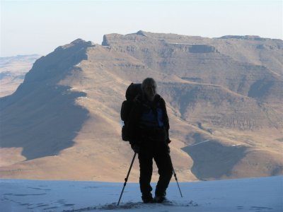
I couldn't agree more with both your suggestions. It truly is a spectacular and unique pass and would be an absolute shame if this section became permanently impassable. Just by assessing the successive damage caused by our group of 4 crossing (and the sheer horror of feeling the ground below you give away completely at each step) I am really concerned whether it can be crossed safely at all by next groups in its current condition. For those that have not done the pass before, as can be seen from the images, there is a significant drop-off and the gradient is more than may be perceived.
I would generally be hesitant to issue a warning like this (acknowledging the risk we all happily take to experience our beloved mountains) but as Elinda has mentioned, it may be the responsible thing to do to make everyone fully aware of this specific risk (especially if and when conditions change). Given sufficient time, I am confident that it can be rehabilitated.
Please Log in or Create an account to join the conversation.
- supertramp
-
- Offline
- Elite Member
-

- Posts: 185
- Thank you received: 350
Has anyone been up or down Nguza Pass recently? If so, is the tricky section on the traverse still in a bad state or has it started to recover? Hoping to go down it on Saterday so any information would be appreciated!
Many thanks
Please Log in or Create an account to join the conversation.

Did you end up doing Nguza pass? Looking at it as an option for my next hike.
Thanks
Please Log in or Create an account to join the conversation.

Take nothing but litter, leave nothing but a cleaner Drakensberg.
Please Log in or Create an account to join the conversation.

Please Log in or Create an account to join the conversation.
- tonymarshall
-

- Offline
- VE Advisory
-

- Posts: 740
- Thank you received: 2097
The map below shows the track in green and the waypoints, and the magenta track (not included in the gps file) is the Rockeries Pass route.
Please also read the relevant write ups in this thread for more information on the Nguza Pass route, and don't only rely on the gps track.
Please login or register to view the image attached to this post.
Please Log in or Create an account to join the conversation.
- tonymarshall
-
- Offline
- VE Advisory
-
- Posts: 740
- Thank you received: 2097
Take nothing but litter, leave nothing but a cleaner Drakensberg.
Please Log in or Create an account to join the conversation.
Head up the river valley towards the pass itself. You will clearly see the waterfall section you would have to climb if you don't want to do the side gully section. Once you are near the waterfall area (I don't have the exact measurements, but I would say start looking from about 500m away), start looking towards your left (true right) for a steep sidegully with a massive chockstone near its bottom. Turn left into this gully. I found it easiest to get over the chockstone by climbing up on the right. From here, simply walk up till you get to the top. You will be blocked by a rock wall at the top. Turn right here onto the grassy ledge. Even in mist this part is unmistakable.
Simply follow this ledge to the right till you come to another short, steep grassy gully on your left. You will wind in and out of a few gullies on the way, passing the infamous short section where you have to go over a bit of a dodgy gap section. If you're not sure what I'm talking about, don't stress, when you get here you will definitely recognise this spot. The grass gully is shortly after this spot to your left. Short, steep, but entirely manageable. There are a lot of these long, thick, grassy type of plants in this gully (yellow flowers, plant is about 50cm high, fleshy leaves).
Lots of good camping spots near the top and the river is also close by.
Enjoy!!!
Please Log in or Create an account to join the conversation.

