
The coming home project
13 Sep 2018 05:31 #73990
by AndrewP
The coming home project was created by AndrewP
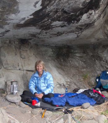
For the better part of the year, I have been planning a "coming home" project. The idea is to be dropped off at a not so random spot, and then run home (Pretoria East). Following the obvious "feature". It took a few paragliders to come up with a similar concept to get me off the coach, so a week from now I will be having a go.
"AndOSM" has some nifty routing options that allow me in a single click to work out an optimal route that favours bushes and rocks over dodgy roads. It also tells me I have the better part of 200km to go and about 7000m ascent/descent.
The route does not blend well to online tracking by a mass audience. If anyone is interested in following me, please pm me and I will add you to a whatsapp group.
Either way, a few pics and a write up will follow
Please login or register to view the image attached to this post.
Please Log in or Create an account to join the conversation.
13 Sep 2018 11:38 #73997
by Sabine
Replied by Sabine on topic The coming home project
Good luck with the run
Please Log in or Create an account to join the conversation.
25 Sep 2018 05:47 #74030
by AndrewP
Replied by AndrewP on topic The coming home project
In the end, I decided to start near the N1 and run towards Sun City. This fitted in better with the direction the paragliders where taking. And meant I could cover a whole lot of new ground while I was fresh enough to appreciate it.
It took me a few scenic detours to get onto the ridge. Then, I followed good paths / tracks all the way to the R80, with a minor detour into the streets to cross Steve Biko, a railway line and a dodgy river.
From the R80 westwards, the paths mostly die, and rough terrain is the norm. I was lucky in that a fire had burnt most of the grass making the rocks visible at least. The trade-off is that after a while I looked like a chimney sweep. I was also lucky with a cool day - the sun only came out about 11am, and even so, for the next 2 hours was still pretty weak. I thus got all the way to the Harties cableway station on just over 2l of water. I used the chance there to fill up with water and to buy some cold coke. The day was very hazy though, so views were just not what they could have been.
On the way down to the dam wall, I started noticed some chafing. At this point, I decided to stop when I reached the dam wall. It would mean I had completed a solid leg of the entire traverse, and I would then adjust my strategy to that of the paragliders who have 6 weeks to pick the right conditions to try fly from the dam wall to Sun City. And, I can then complete the entire thing in daylight, which is not only faster and more pleasant but will give me a chance to see the view.
All in all, a great day out. All of it was new to me (expect about 50m near the cableway). It was great to just get out into the hills that are this close to home, and are still relatively untouched.
Starting out, N1 in the background
Brief trip down into busy morning streets
Some paths are easier than others
Alternative uses for mountains
Someone went to a lot of trouble to make this path
Lots and lots of rocks. At least by here I could here birds and see baboons instead of the constant noise of traffic earlier
Cableway hill finally in sight
Dam wall")
It took me a few scenic detours to get onto the ridge. Then, I followed good paths / tracks all the way to the R80, with a minor detour into the streets to cross Steve Biko, a railway line and a dodgy river.
From the R80 westwards, the paths mostly die, and rough terrain is the norm. I was lucky in that a fire had burnt most of the grass making the rocks visible at least. The trade-off is that after a while I looked like a chimney sweep. I was also lucky with a cool day - the sun only came out about 11am, and even so, for the next 2 hours was still pretty weak. I thus got all the way to the Harties cableway station on just over 2l of water. I used the chance there to fill up with water and to buy some cold coke. The day was very hazy though, so views were just not what they could have been.
On the way down to the dam wall, I started noticed some chafing. At this point, I decided to stop when I reached the dam wall. It would mean I had completed a solid leg of the entire traverse, and I would then adjust my strategy to that of the paragliders who have 6 weeks to pick the right conditions to try fly from the dam wall to Sun City. And, I can then complete the entire thing in daylight, which is not only faster and more pleasant but will give me a chance to see the view.
All in all, a great day out. All of it was new to me (expect about 50m near the cableway). It was great to just get out into the hills that are this close to home, and are still relatively untouched.
Starting out, N1 in the background
Brief trip down into busy morning streets
Some paths are easier than others
Alternative uses for mountains
Someone went to a lot of trouble to make this path
Lots and lots of rocks. At least by here I could here birds and see baboons instead of the constant noise of traffic earlier
Cableway hill finally in sight
Dam wall
Please login or register to view the images attached to this post.
The following user(s) said Thank You: elinda, Stijn, ghaznavid, tonymarshall, Andreas, TheRealDave, WarrenM, Super_mil
Please Log in or Create an account to join the conversation.
07 Feb 2019 04:58 #74627
by AndrewP
Replied by AndrewP on topic The coming home project
This weekend, I tackled the far western end of the project.
The paragliders want a dramatic entrance to Sun City by landing at the Lost City club house. I thus started there.
It is a solid 25km of tar road from where I really wanted to start. I did most of the road in the dark, and to be honest do not feel like I missed anything. Flat with a few mines along the way. Boring.
I did eventually see the Magaliesberg rising up in front of me, and a little later I had found the spot at which I had planned to leave the road.
The vegetation was worse than expected - a solid wall of thorn trees. Some quality time scanning satellite images though had revealed that 100m away, was a clearing and that from this a vague break led in the direction I wanted. It was a bit humbling to see my pace plummet from running steadily the whole way to suddenly crawling through the bushes.
I got onto the ridge line soon enough. The initial portion of the range has more fences than I have seen elsewhere, which kept me on my toes. The ridge is definitely smaller here than the main stretch, but looks the same. I found the going tougher though as there are fewer paths and hence rather a lot of bush bashing.
I lucked it out on weather. Cloud cover all day and even a little mist at one point for that big mountain feeling.
It had rained almost all of the night before, so I took a chance and emptied out 2l of water I had originally planned to carry. I hoped to fill up from a little pool of rain water - this did not happen so, I had a long and dry run. Then again, if I had carried that water I would have gone slower and run out of water at the same spot, just later in the day. Either way, long hauls in the Magalies are going to be thirsty work. I thus pulled out a lesser known trick and decided to swap out some water for a can of peaches. The sugar in the syrup hits a spot like nothing else.
After a while, I crossed the N4 as it cuts through the mountains between Rustenburg and Swartruggens. I knew from a previous drive out this way that if you hang a right, you soon come across a little shop. Much as I like the idea of doing this self-supported, it is rather silly to carry 10l of water when you run this close to supplies. This was my first water in 50km, so I stopped for a while to drink and fill up.
I then got back onto the ridge. At one point, I was forced to drop down into a saddle, and luckily saw a vague path on the other side. I aimed for this, but found myself climbing down a whole lot of little cliffs. I later turned round and saw a lovely grass ramp 100m left of where I had come down. The joys of new ground By now, I was approaching Rustenburg.
I eventually stopped a short way from the entrance to the nature reserve. One of the paragliders had come to pick me up (paragliders use a lot of seconding as they hardly ever land at the spot they started from).
I still need to link the bit between here and Mountain Sanctuary Park to be able to claim the t-shirt.
The paragliders want a dramatic entrance to Sun City by landing at the Lost City club house. I thus started there.
It is a solid 25km of tar road from where I really wanted to start. I did most of the road in the dark, and to be honest do not feel like I missed anything. Flat with a few mines along the way. Boring.
I did eventually see the Magaliesberg rising up in front of me, and a little later I had found the spot at which I had planned to leave the road.
The vegetation was worse than expected - a solid wall of thorn trees. Some quality time scanning satellite images though had revealed that 100m away, was a clearing and that from this a vague break led in the direction I wanted. It was a bit humbling to see my pace plummet from running steadily the whole way to suddenly crawling through the bushes.
I got onto the ridge line soon enough. The initial portion of the range has more fences than I have seen elsewhere, which kept me on my toes. The ridge is definitely smaller here than the main stretch, but looks the same. I found the going tougher though as there are fewer paths and hence rather a lot of bush bashing.
I lucked it out on weather. Cloud cover all day and even a little mist at one point for that big mountain feeling.
It had rained almost all of the night before, so I took a chance and emptied out 2l of water I had originally planned to carry. I hoped to fill up from a little pool of rain water - this did not happen so, I had a long and dry run. Then again, if I had carried that water I would have gone slower and run out of water at the same spot, just later in the day. Either way, long hauls in the Magalies are going to be thirsty work. I thus pulled out a lesser known trick and decided to swap out some water for a can of peaches. The sugar in the syrup hits a spot like nothing else.
After a while, I crossed the N4 as it cuts through the mountains between Rustenburg and Swartruggens. I knew from a previous drive out this way that if you hang a right, you soon come across a little shop. Much as I like the idea of doing this self-supported, it is rather silly to carry 10l of water when you run this close to supplies. This was my first water in 50km, so I stopped for a while to drink and fill up.
I then got back onto the ridge. At one point, I was forced to drop down into a saddle, and luckily saw a vague path on the other side. I aimed for this, but found myself climbing down a whole lot of little cliffs. I later turned round and saw a lovely grass ramp 100m left of where I had come down. The joys of new ground
By now, I was approaching Rustenburg.I eventually stopped a short way from the entrance to the nature reserve. One of the paragliders had come to pick me up (paragliders use a lot of seconding as they hardly ever land at the spot they started from).
I still need to link the bit between here and Mountain Sanctuary Park to be able to claim the t-shirt.
Please login or register to view the images attached to this post.
The following user(s) said Thank You: elinda, Stijn, JonWells, ghaznavid, tonymarshall, pfoj, Richard Hunt, TheRealDave, WarrenM
Please Log in or Create an account to join the conversation.
