
Hex River Traverse
Does anyone have GPS data for routes in and around the Hex River mountains in the Western Cape?
We are trying to piece together a two-day weekend hike. Looking for GPS data or even maps etc.
Thank you
G
Please Log in or Create an account to join the conversation.
- advocate_gerrie_nel
-
 Topic Author
- Offline
- Senior Member
-

- Posts: 53
- Thank you received: 44
") As I paddled with Johnny Heatlie on Sunday and he said he took someone up their mountain recently.
As I paddled with Johnny Heatlie on Sunday and he said he took someone up their mountain recently. Please Log in or Create an account to join the conversation.
AdrianT wrote: Are you the guy who went up Ben Thomas the other day as part of a recce for this? Just wondering
Nope, not me. We have attempted Matroosberg from De Doorns side and made it 70 percent up...but now a trip in the Waaihoek area us on the cards. We were suggested to park at Fairy Glen game farm, sleep at Thomas Hut night 1 and around Pells hut night 2. But need more info..
Please Log in or Create an account to join the conversation.
- advocate_gerrie_nel
-
Topic Author
- Offline
- Senior Member
-
- Posts: 53
- Thank you received: 44
I think elevation gain for that peak is 963m according to my old Suunto. It is the lowest of a series of peaks. When you leave Worcester, as soon as the Hex River goes under the N1, their farm on the left hand side.
Location of Ben Thomas:
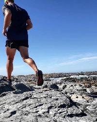
More photos from a solo hike I did where I slept at the top, and another with Johnny that got down to 3 degrees before we went to bed with a stiff 35 knot wind. Spectacular area.
Please login or register to view the images attached to this post.
Please Log in or Create an account to join the conversation.

Please Log in or Create an account to join the conversation.
AdrianT wrote: Ok well if you want permission to get in and hike Ben Thomas and the surrounds let me know. From there you could also traverse and go as far as you wish I guess. And at least you have a safe place to leave your car.
I think elevation gain for that peak is 963m according to my old Suunto. It is the lowest of a series of peaks. When you leave Worcester, as soon as the Hex River goes under the N1, their farm on the left hand side.
Location of Ben Thomas:
More photos from a solo hike I did where I slept at the top, and another with Johnny that got down to 3 degrees before we went to bed with a stiff 35 knot wind. Spectacular area.
Thanks Adrian, this sounds like an epic adventure and is definitely an option (if not next weekend). The problem with piecing together an own traverse is those mountains are unrelenting - very easy to lose a few hours amongst those neverending ridges!
Please Log in or Create an account to join the conversation.
- advocate_gerrie_nel
-
Topic Author
- Offline
- Senior Member
-
- Posts: 53
- Thank you received: 44
This is a spectacular traverse with intricate route finding - really feels like a proper mountain wilderness. I'd recommend 2.5 - 3 days to get the most value though.
Will post some pics when I have more time later.
Please Log in or Create an account to join the conversation.

Stijn wrote: A brilliant traverse in the Hex is the Thomas Hut - Perry Refuge - Pells Hut Traverse. I don't have maps handy right now, but you'll need to contact the MCSA for access to Thomas Hut and surrounds and possibly the UCT MSC for access to the Pells Hut side and descent on their Zuurberg property.
This is a spectacular traverse with intricate route finding - really feels like a proper mountain wilderness. I'd recommend 2.5 - 3 days to get the most value though.
Will post some pics when I have more time later.
Thanks Stijn, this is the exact route we are trying to piece together. A friend of mine (Paddy Chapple - you had email correspondence with him?) is a MCSA and Mountain Rescue member and got the suggestion, permissions etc. Do you know if Slingsby makes maps for this area? Will ask Paddy to enquire with his contacts
Please Log in or Create an account to join the conversation.
- advocate_gerrie_nel
-
Topic Author
- Offline
- Senior Member
-
- Posts: 53
- Thank you received: 44
The farmer is a mountaineer himself - and set a very impressive record of under 2 hours from bottom to top. He sends his two dogs with you (they know the way) if you give him notice (we didnt have the dogs but will require their services on our follow-up attempt). There is a cave at around 2000m where one could overnight.
(Edit - Now I must revert my attention to work and stop daydreaming about high peaks and impenetrable ridges)
Please login or register to view the image attached to this post.
Please Log in or Create an account to join the conversation.
- advocate_gerrie_nel
-
Topic Author
- Offline
- Senior Member
-
- Posts: 53
- Thank you received: 44
The difficult bit with intricate route-finding is from the summit of Fonteintjiesberg all the way across to the summit of Mt Brodie. Only attempt this section in good weather..
*disclaimer - it's been 12 years so my memory may be a bit vague in places!
Please login or register to view the images attached to this post.
Please Log in or Create an account to join the conversation.
