
Giant’s Castle Traverse
ghaznavid wrote: Around the Corner Pass (the local variation route on Corner Pass) is a bit of an anomaly. I am not sure if I should include it under phase 1 or 3, but more on that to follow.
...
So with that – Corner Pass had fallen and phase 1 of Project Giant’s Castle was complete.
Kind of forgot to finish my thought on that point...
So Around the Corner Pass has a clear trail, and even if it is barely (if at all) used by hikers, it is still a definite and defined pass at Giants Castle and accordingly I declare phase 1 incomplete.
 Although that provides me with an excuse to go and do more hiking
The majority of the Northern Gully and the entirety of the Eastern Gully are at Lotheni by the defined boundaries, so those can stay on the backburner for the moment - but they are on my radar, seeing as Project Lotheni has not been conclusively ruled out as a future project...
Please Log in or Create an account to join the conversation.

Our water retrieval tool
Ghaz topping out on Corner pass
Ghaz on the Corner high point
Hanging with locals on the Judge
The Judge
Shadows of the Escarpment on the clounds
“Today is your day! Your mountain is waiting, So… get on your way!”
Please login or register to view the images attached to this post.
Please Log in or Create an account to join the conversation.

Ghaz admiring the view
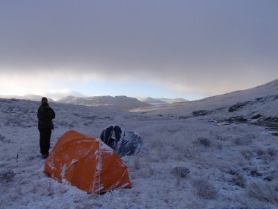
My view from Ghaz's pic of me "sleeping"!
“Today is your day! Your mountain is waiting, So… get on your way!”
Please login or register to view the images attached to this post.
Please Log in or Create an account to join the conversation.
Please Log in or Create an account to join the conversation.
- BobbyStanton
-

- Offline
- Elite Member
-

- Posts: 139
- Thank you received: 94
BobbyStanton wrote: That's not the Red Wall Falls. They are in the next valley to the north. This stream is the one that runs down the valley in front of Injasuti Summit cave. See Tony Marshall's report and pictures of his hike up Corner Pass.
Anyone have an official name for this waterfall? Perhaps Injisuthi Falls?
Also looks very high - probably about 400m? Anyone got anything more conclusive than contour lines on Google Maps?
Please Log in or Create an account to join the conversation.
Please Log in or Create an account to join the conversation.
You would need a rope to pass packs down, I don't think there's much to anchor a rope for abseiling off though. I wouldn't want to downclimb it, but I'm sure it can be done.
Please Log in or Create an account to join the conversation.
Please Log in or Create an account to join the conversation.

firephish, we once come down Corner Pass in the rain with a 3m ski rope. Not advisable. There were some inexperienced people in the party, and we had to body-belay them down. The last guy then has to solo it, although he can be spotted. The scrambles are more doable when dry, I guess, but it is a really uncomfortable place to hurt yourself.
Please Log in or Create an account to join the conversation.

Viking wrote: My view from Ghaz's pic of me "sleeping"!
@Viking: darn - we forgot to get the shot of what our shoes looked like by the end of it.
The route was tough on our shoes - especially the top of Giant's Pass (before we lost the path). It has plenty of loose gravel and scree.
Please Log in or Create an account to join the conversation.
