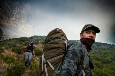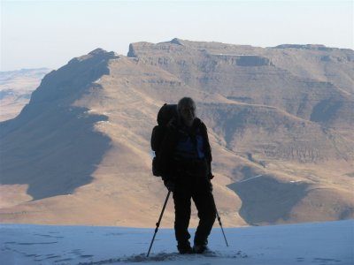
This is a pass which suits the Mnweni area perfectly. Great views of the spires that jut out below the Mbundini Buttress, tricky route finding due to the absence of a path and a tough climb overall. It summits near the top of Stimela Peak with one of the best views of the Mnweni Cutback below you.


Rating:
* * *    7/10
Difficulty of the pass is rated from 1-10 (10 being very difficult, only to be attempted by the fit and experienced). A subjective quality rating is indicated by the number of stars (1 being low, 5 being the highest). Factors such as scenic beauty and overall experience come into play here, which may differ from person to person.

Access:
Mbundini Pass is accessed by a long day’s walk-in (21 km) from the Mnweni Cultural Centre. The Mbundini River valley leaves the Mnweni River just before Shepherd’s cave. The pass starts where the tributary from Fangs Pass meets this river at a rather large dagga field.

Details:
The distance from the dagga field to the top of Mbundini Pass is 3 km with an altitude gain of 1100m.

Route:
There is a faint path which heads up the ridge between the Fangs tributary and the Mbundini River. It peters out just below the first rock band. Contour around to the right until you reach a passable route through the rock band about 500m further on. You should now set a diagonal line to the top of the pass, weaving your way through the intermittent rock bands on the way. Make sure you stay well above the river and closer to the basalt cliffs on the left-hand (southern) slopes of the pass. The reason for this is that there are a few scree fields and landslides on this slope which are easier crossed higher up. Keep left (south) of the river/boulder bed all the way to the top of the pass at 3100m.

Finding the pass from the escarpment:
High up on the southern slopes of Stimela Peak, above the Mbundini Abbey and just to the right (south) of the Mbundini Buttress is a large gully which runs down the escarpment edge with a cairn on top of it. This is the Mbundini Pass.

Overnight Spots:
There are a couple of nice campsites near the dagga field at the bottom of the pass at a small waterfall. There is also lots of camping on the escarpment itself. The Mbundini cave near the top of the pass is poor shelter and should be avoided.

Water:
The only water on the pass is right at the bottom at the small waterfall. Once you start heading up the ridge, there is no water until the river on the escarpment which is about 500m from the top of Mbundini Pass.
 

Log in to comment


intrepid's Avatar
intrepid replied to: #80503 Yesterday 19:37
The deliberation of "slope vs gully" often features when it comes to passes. People's preferences naturally come into play here and probably accounts for how people navigate this pass.

Gullies and river beds require less navigational effort, offer less exposure, and tend to feel more "secure" to people. On the other hand they can be quite laborious, the boulder hopping and loose rubble requires effort, the "ouhout" can be a pain, and slimy and watery conditions is also a factor. Slopes can be faster and more efficient. Provided you hit the right trajectory on them, they often at least "feel" like the better option. Yes, steep slopes can be more ankle-twisty and many people don't like the insecure feeling of being on steep grass, but arguably they can also offer more consistent "micro-terrain" where you don't have to zig zag around boulders, bush and water. Slopes may also be more scenic.

Wilson's Pass is another example where this difference in preferences becomes evident. If you go through that thread you'll see some references to that. I found a slope route that significantly bypassed the gully of that pass and I found it to be more "cruise-y", whereas other commented that they definitely felt better about taking the gully.

That being said, Mbundini is pretty steep overall, yes and laborious. The option of camping at the Mbundini/Fangs fork, going up Mbundini and down Fangs in a day without a heavy pack seems more appealing to me, rather than repeating it with a full pack again.
tonymarshall's Avatar
tonymarshall replied to: #80502 14 Oct 2026 09:20
Just to clarify the differences between the VE Mbundini Pass gps track, and my write up(s), the gps track is not mine. The gps track was uploaded in 2008, and I did the pass in 2013, when I still had very little gps knowledge and was only able to record the route we did on my gps. In 2017 the group was happy to follow a similar route to my 2013 track, and chose the side slopes above the river. 
Riaang's Avatar
Riaang replied to: #80499 07 Oct 2026 09:40
Hi MikeCross,

I've descended this pass a number of years ago and we stayed high for most of the way, only descending once we were maybe about a km or so from the typical camping spot at the waterfall in the riverbed. Conditions have probably changed quite a bit since then, but we found the side slopes, how shall I put it, "Unfun"!!! It was very loose and the going was difficult as my hiking pole would go into the loose sand about 40cm or more regularly. Eventually my left ankle gave out and I had to climb up to the top of the ridge and walk down to the campsite from there, which, although steep, was far better on my ankle. Carrying a very heavy pack didn't help me in this case, but everyone in the group eventually complained about the never ending steep sideslope that was way too loose for our comfort. If I ever had to do this pass again (which is highly doubtful) I'd stay in the riverbed and stay away from the sideslope.
MikeCross's Avatar
MikeCross replied to: #80498 06 Oct 2026 13:36
Hi Wonderful members of VE,

Thought I'd share my hapless 2c on this pass. Came down it last Sunday in some heavy mist armed with an extensive study of this thread and the gpx provided. I came from the cave a short ways down the pass on the true right (which really is a stunning overnight spot) and tried to stay out of the scree fields but was lulled into them by the gpx line and path-like evidence of prior use. I didn't want to venture too far out the gully because I had no good view with the mist and sticking to the trail of destruction seemed like the better option. This is when things got type 2 fun and my admittedly worn trail-runners started letting me down in the wet and I found myself using the butt-scoot method of descent numerous times to enter the more bushy section where I finally got out of the gully and onto the side-slope. From here I had no real issues. I'm thinking taking my own path across the grass on the true right could've been better but can't be certain as the bushy section crossing a stream seems to match Tony Marshall's description. Could this bushy stream crossing section be a choke-point of sorts? If we're doing the Fangs comparison I'd say this pass is a notch above Fangs (I think it's steeper overall) but I came up and down Fangs in perfect weather with a fun group and this was solo in greasy conditions. I can imagine a world where "knowing the tricks" of this pass would make it quite a lot easier but I'll have to give it another go or two to learn them, maybe with proper shoes and more than 50m visibility. I've included a pic of my route vs the gpx and a line that I think could be preferrable (and potentially match the detailed descriptions on this thread) to what is indicated by the gpx.

Happy hiking, everyone!

 
tonymarshall's Avatar
tonymarshall replied to: #71672 31 May 2017 07:38
On the 27th April long weekend, Lorinda, Christine, Stephan, Lenard and tonymarshall ascended Mbundini Pass and descended Fangs Pass. In line with AndrewP’s advice, I can recommend some tough passes and khulus as good training for the Mnweni Marathon, but maybe two weeks before was too close to the event to recover fully.

When I had descended Mbundini Pass in 2013, my camera was broken and I used elinda’s photos for the pass write up at the start of this thread, and nobody visited or took photos of Mbundini Cave. This time I made a point of going to Mbundini Cave, and taking some photos, while the rest of the group waited in the pass for me. The photo below is the view back to the pass from Mbundini Cave. There is another overhang across the pass, but it didn’t look worth checking out so I didn’t.


A low wall has been built which divides the level floor area into two sections. The better, larger area is on the eastern side (in reference to the pass, the downslope end) of the wall, and three or four people could sleep here.


There is also a small area on the west side of the wall where two people could sleep.


The east side sleeping area looking over the wall.


Looking back down the pass, Mbundini Cave is on the right, at the bottom of the rock band to the right of the broad grass slope behind the hikers in the photo below.


My gps co ordinates for Mbundini Cave are S28° 50.790' E28° 56.943' at 3010 m. The cave is about 150 m vertically below the top of Mbundini Pass, and 350 m horizontally away.
ghaznavid's Avatar
ghaznavid replied to: #63593 03 May 2015 17:46
Photo taken yesterday, story to follow soon...
travissmcdonald's Avatar
travissmcdonald replied to: #56818 06 May 2013 21:29
ive done fangs,hard as hell but loved it,physically hardest pass ive done,ifidi just gnarly,esp when iced up.doin icidi next month,have yet to see any good comments on it
plouw's Avatar
plouw replied to: #56491 03 Apr 2013 09:07

The experience one has of a pass can be very dependent on weather, load, time of start, time of year, company and many other issues. So I would be wary of claiming a definitive ranking from a single ascent or a single descent.


I fully agree wth this statement. Fitness and group dynamics also play a big role. I have done Corner in snow and ice with a fit group and it was very enjoyable, Ships Prow with a friend on the verge of an emotional breakdown made the pass seem a lot worse and Fangs in perfect cool weather felt like the equivalent of a trip down Mashai pass.
tiska's Avatar
tiska replied to: #56490 03 Apr 2013 08:56
And for me Mbundini is easier than Fangs.

The experience one has of a pass can be very dependent on weather, load, time of start, time of year, company and many other issues. So I would be wary of claiming a definitive ranking from a single ascent or a single descent. I've been up and down Mbundini 3 times and have gotten to know its tricks. I like the pass. Fangs I have been up just once and had a hard time of it. That alone might explain my ranking.
ghaznavid's Avatar
ghaznavid replied to: #56487 03 Apr 2013 07:13

intrepid wrote: ghaznavid has kindly offered to carry my pack up the pass when I do it again.


:laugh: cool, lets go and do the pass next weekend...
Helping Hobbit with 3kg's of his weight this last weekend has reminded me of the difference made by even a small amount of extra weight. Alternatively I have become very slack on training this year :whistle:
intrepid's Avatar
intrepid replied to: #56485 03 Apr 2013 07:05
Mbundini is a worthy one for the Mnweni. Personally I would also rank it harder than Fangs. The views of it from below don't tell the full story. It's long, pretty steep and a few obstacles in the upper section (scree and small gullies), not to be underestimated.

ghaznavid has kindly offered to carry my pack up the pass when I do it again.
Jax's Avatar
Jax replied to: #56457 02 Apr 2013 12:55
Agreed Elinda! We did Mbundini over this Easter weekend and 3 of our group of 4 did Fangs last year and all agree that Mbundini is harder and requires more concentration. Also one that I would think twice about doing again while there are others out there waiting.
Geordie will provide our hike report shortly and we'll post a few pics.
elinda's Avatar
elinda replied to: #56456 02 Apr 2013 11:54
Thanks for the write up Tony! I would not say it is an 'easy' Pass, obviously easier than Ifidi or Icidi but right up there amongst the strenuous and 'slope sliding' category of Berg passes....... :ohmy:
tonymarshall's Avatar
tonymarshall replied to: #56446 01 Apr 2013 19:00
On the way down we had to cross several steep sided side gullies.


Lower down the sideslope got steeper and remained very steep for a long way.


We could look down into the river valley below us, and the steep grassy slopes was definately preferable to the boulder strewn, bushy river bed with numerous waterfalls, vertical sections and narrow channels. Lower down the slope became quite bushy, although there was a slight path in this section. We also crossed a side stream in this bushy section, the only water source on the pass (unless of course you follow the river bed).


A view up Mbundini Pass showing the lower area of the bushy section.


After this we onto the ridge between the Mbundini and Fangs valleys, with a rough path and heaven for our sore feet, no side slope.


From this ridge there is a good view up Fangs and Mbundini Passes, Fangs on the left and Mbundini on the right.


From the top of Mbundini Pass we could make out the junction of the Mbundini River and Fangs Stream, and from quite high up we could see the waterfall where the routes join (or split if going up). The photo below of the view up Mbundini Pass is taken from near the waterfall.


After resting a while at the waterfall, we continued on the path downstream to overnight in Five Star Cave. It had become really humid with an approaching thunderstorm, and a dip in the Mbundini River near the cave was a welcome respite for everyone. That night we watched the storm from the sanctuary of the cave and were grateful to be in dry shelter from the heavy rain. The next morning we walked out through the wet grass to the road, and got a lift along the road back to the Mnweni Cultural Centre, concluding another epic Mnweni hike.
tonymarshall's Avatar
tonymarshall replied to: #56445 01 Apr 2013 18:29
edit: Trip report www.vertical-endeavour.com/forum/drakensberg-trips/55788-fangs-mbundini-loop-the-dragon%E2%80%99s-teeth.html

Full Pass Writeup
After ascending Icidi Pass the previous day and tenting near the top of Icidi pass, we traversed across the summit past the back of Stimela Ridge to the top of Mbundini Pass, our chosen pass to descend. All photos courtesy of Elinda.


As with several of the Mnweni area passes, you get a spectacular view of the Mnweni Needles from the pass, and near or at the top, beyond to the Cathedral Range.

We did the recommended route of the pass and followed the grass slopes down on the right (true right) side of the valley.


The photos above and below show the grass slopes near the top of Mbundini Pass, with the view down the pass.


A short way down the pass we had to cross a scree slope, which was steep and a bit unstable,


and we plotted our route lower down to avoid three more scree slopes to the right.


We frequently paused to admire the view, and select the route of the next section of the pass.


The gradient of the pass was steep, and a lot of the time we were also on a very steep sideslope.


A view back up Mbundini Pass from below the scree slopes.