
Blog
Drakensberg Caves GPS Co-ordinates
- Details
- Written by Chris Sommer
- Parent Category: Drakensberg
- Category: Caves
- Hits: 9488
Many hikers can relate how difficult it can be to locate a cave in the Drakensberg sometimes. Having a tested GPS co-ordinate for the cave you are heading to is very reassuring - assuming you know how to navigate with it. The use of a GPS can no longer seen as a high-tech toy. Rather it has become highly valuable in increasing the safety and quality of a trip to the Berg. A list of GPS waypoints for Drakensberg caves in the KwaZulu-Natal section is hereby provided.
Discuss this article
Log in to comment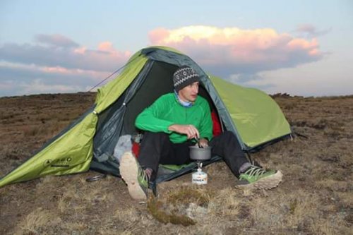


I have finally gotten around to putting out an update to the caves GPS data download. Up until this point the data has been only that which I have captured personally, for this update I have included data from Rhinoandhedgehog and from MarkT - thank you for contributing! The following caves were added: Venice Cave, Chameleon Cave, Barker's Chalet, Aasvoelkraans Cave and Caracal Cave.
Further contributions to this download file are welcome and the contributors are acknowledged on the main download page for the file . Contributions should be data that is as accurate and reliable, so please only submit good readings that you are confident of. I know sometimes the weather and location make accurate readings difficult. Reviews of existing waypoints in the download file are also welcome (for example if more accurate readings are available).
Further contributions to this download file are welcome and the contributors are acknowledged on the main download page for the file . Contributions should be data that is as accurate and reliable, so please only submit good readings that you are confident of. I know sometimes the weather and location make accurate readings difficult. Reviews of existing waypoints in the download file are also welcome (for example if more accurate readings are available).
We notice that the following cave is not in the downloadable file hopefully can be added with the next up date along with the caves list above.
Barker's Chalet S28 56.123 E029 11.137 Elevation 1733m Max 10 people (looks like it could hold more).
Good water supply all year round.
Barker's Chalet S28 56.123 E029 11.137 Elevation 1733m Max 10 people (looks like it could hold more).
Good water supply all year round.
For the next update I can add;
Caracal Cave S29 17.548 E029 35.843 Elevation 1853 Max 12 people
Aasvoelkrans Upper S29 18.019 E029 37.660 Elevation 1910 Max 12 people
Aasvoelkrans Lower S29 18.037 E029 37.670 Elevation 1897 Max 12 people
All close to a good water supply.
All can be downloaded here with the routes
Highmoor - The Three Highmoor Caves


Hi Team - I just wanted to appreciate everyone that has been involved in putting together these co-ords. of the cave, we found Roland's for the first time this weekend in the dark on Friday night, fairly easily as a result of using the details above.
Thank you
Thank you
@MarkT: thanks for drawing my attention to this. I have now removed the <time> tag where it was present for certain waypoints from the GPX data. This should account for the behaviour you saw on Google Earth. The new version is now available on the download page.

That's awesome, thanks intrepid. My suggestion would be to strip the dates out of the waypoints. When I open the gpx in Google Earth, there is a time slider that appears at the top left, and if I move the sliders, some of the caves disappear and reappear. I don't know why this happens, I expect it's because each one has an associated date and Google Earth thinks you might want to hide the old ones?
I have published a much needed update on the cave GPS data download:
www.vertical-endeavour.com/downloads/download/9-drakensberg-caves/5-gps-data-of-caves-in-the-ukhahlamba-drakensberg-park.html
The number of listed waypoints has increased from 73 to 107. Note that there are many more waypoints that could be added, but for the time being I have decided not to (for example, some unnamed shelters may simply be too unreliable to promote in this way). I also do not list rock art shelters (with a few established exceptions), or caves that are officially closed to hikers for other reasons.
I would like to issue a "recall" of the name "Dagga Planter's Cave". Please forget this name and do not use it. It was an arbitrary name I assigned to what is actually Five Star Cave, and I apologise for the confusion that the introduction of this name has caused. There have been differences of opinion as to which cave is Five Star, depending on which tradition you were taught. This has now been cleared up, and more can be read about it in the thread Which cave is Five Star Cave? . Note that this error still persists on some maps.
Several shelters and caves listed in the download file do not have official, or even widely known colloquial names. In these cases I have traditionally simply given my own name. or used names suggested by others. I would like to emphasize that these names are suggestive, and that they are open for scrutiny and should assigned other names, if already in existence, or if the new name is shown to be more appropriate. The Berg has many cases of erroneous, inappropriate and misplaced names, and given the community we have here now, I submit that we can do much better when it comes to naming things. As a step in this direction, where appropriate I have now flagged caves with the text "*suggested name*" in the comments space of the waypoint. This means the name is still open for scrutiny and wider input, in my view.
As I update various downloads, I am now also adding the official forum link in the download description text, where all relevant discussion, updates and corrections relating to the data can be posted. This particular thread is the official one for the caves download.

QGis is available here:
www.qgis.org/en/site/forusers/download.html
and the S A spatial vector data (contours, rivers, roads, etc) is here. You might have to phone them as their website is a mess:
www.ngi.gov.za/index.php
www.qgis.org/en/site/forusers/download.html
and the S A spatial vector data (contours, rivers, roads, etc) is here. You might have to phone them as their website is a mess:
www.ngi.gov.za/index.php
The satellite imagery is Google Earth. Microsoft Virtual Earth is usually better but had some cloud cover in the wrong place. You need a good GIS (Geographic Information System) to place layers of spatial information and to look after the various projections and datums while doing this. I suggest QGis (Quantum GIS) which is open source ie. free. It has a steep learning curve for a beginner however. You also need to brush up on your knowledge projections before starting out.
These pictures have a base projection known as Spherical Mercator which is what most available satellite imagery is in. ie. the earth is assumed to be spherical instead of spheriodal and the coordinates are in the Mercator projection. This allows Google or MS Virtual Earth to calculate locations and distances very quickly as you pan and zoom the image in your browser. The contours are from the Surveyor-General (or whatever they are called now) and are also free. They are in WGS84 or unprojected. The cave coordinates were picked off the previous posts (also presumed to be WGS84) and QGis slapped it all together and looked after the different projections so everything lined up. QGis has a plugin that will download various satellite imagerys for the view that you are mapping.
If you have got the time and the inclination to learn all of this terminology I would say it is not rocket science and doable by anyone. It is all available on the internet.


Should be 9 or 10km following mostly an escarpment edge routeASL wrote: Does anyone have the distance between Crows Nest cave and Infidi Cave?

Does anyone have the distance between Crows Nest cave and Infidi Cave?
- You are here:
-
Home

-
Blog
-
Drakensberg
-
Passes
- Mbundini Pass
