
Yodeler's Peak?
17 Jun 2016 17:54 #68849
by AdrianT
Yodeler's Peak? was created by AdrianT
Is anyone able to tell me the name of the peak at this point?
29° 4'57.31"S 29°15'11.24"E
Altitude was about 3331m.
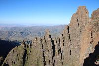
Ghaz says it is probably Yodeler's Peak. I was just curious as to the name of it as confirmation . It seems to have two summits and a large flat top. Cairns at both spots, the southern side was slightly higher if I recall correctly. Thanks!
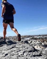
It was super windy for the pic below
29° 4'57.31"S 29°15'11.24"E
Altitude was about 3331m.
Ghaz says it is probably Yodeler's Peak. I was just curious as to the name of it as confirmation
. It seems to have two summits and a large flat top. Cairns at both spots, the southern side was slightly higher if I recall correctly. Thanks!It was super windy for the pic below
This image is hidden for guests.
Please login or register to view the image attached to this post.
Please Log in or Create an account to join the conversation.
18 Jun 2016 13:04 #68853
by BobbyStanton
Replied by BobbyStanton on topic Yodeler's Peak?
Judging by the shape of the Lesotho border, the route up Yodler's valley and the upper Didima Valley to it's right I would say it is Yodler's Peak 1 (see the attached map).
Bobby
Bobby
Please login or register to view the image attached to this post.
The following user(s) said Thank You: AdrianT
Please Log in or Create an account to join the conversation.
- BobbyStanton
-

- Offline
- Elite Member
-

Less
More
- Posts: 139
- Thank you received: 94
19 Jun 2016 10:05 #68855
by AdrianT
Replied by AdrianT on topic Yodeler's Peak?
Thanks so much Bobby. That confirms then what Ghaz also said.
That is an interesting map. Is it self populated/created?
That is an interesting map. Is it self populated/created?
Please Log in or Create an account to join the conversation.
19 Jun 2016 14:41 #68857
by biomech
Replied by biomech on topic Yodeler's Peak?
I was also wondering about that map and the software.
Please Log in or Create an account to join the conversation.
19 Jun 2016 20:31 #68858
by BobbyStanton
Replied by BobbyStanton on topic Yodeler's Peak?
It was made with a GIS (geographic information system) application called ArcMap (proprietory and pricy at the moment). The background should have been white but came out that evil colour for some reason. Here is a version with a satellite image as the background. The red and gold lines are gps tracklogs from various past GTs (going down Yodlers Cascades) and the purple line going to Didima Cave is a tracklog from Tony Marshall I think, or maybe Elinda. The dark and light blue lines are rivers and streams.
If you are keen on getting in to this stuff there is a excellent free open source package called QGis available for downloading (amongst several others). Slightly steep learning curve but not impossible. The other spatial data such as contours, spot heights and rivers came from the Surveyor-General in Cape Town and is also virtually free. You just have to send them some storage medium eg. hard drive.
If you are keen on getting in to this stuff there is a excellent free open source package called QGis available for downloading (amongst several others). Slightly steep learning curve but not impossible. The other spatial data such as contours, spot heights and rivers came from the Surveyor-General in Cape Town and is also virtually free. You just have to send them some storage medium eg. hard drive.
Please login or register to view the image attached to this post.
The following user(s) said Thank You: AdrianT
Please Log in or Create an account to join the conversation.
- BobbyStanton
-
- Offline
- Elite Member
-
Less
More
- Posts: 139
- Thank you received: 94
20 Jun 2016 10:58 #68861
by AdrianT
Replied by AdrianT on topic Yodeler's Peak?
Ah ah, very nice Bobby. It looked like it. My dad was a geologist but sadly he passed about a year and a half ago so I can't ask him to create me some useful maps. I still have his laptops and he has a TNTmips license, GEOVIA (formerly known as Gemcom), ArcGIS etc. I tried my hand at it once before but it's rather tricky - TNTmips in particular. I do have all the 1:50 000 and 1:250 000 maps of South Africa on DVD, I think it took 5 full DVD's, all as *.TIF images but that would be a bit much to upload ") Knowing how to use that software is very useful
Knowing how to use that software is very useful 
Knowing how to use that software is very useful Please Log in or Create an account to join the conversation.
