
Don't look down
The trip we had before we also slept at twins, but it was raining cats & dogs, so the 1 guy - Grant (leader / chairman of a durban based hiking club)-from the group that also slept in twins said it would be too dangerous to try the BT in that weather, so we went down Mlambonja pass.
I've done the Camel (down) during sept last year (the very same trip as I did the section of the BT. Also it was very dry & hot. Just note that there isn't any water on the Camel pass itself. Only in the lower berg you'll find water. Maps do show trickles, but I think that'll only be running in summer or after some rain in winter. The exposed parts on Camel is nothing really, accept in snowy / misty / very windy conditions.
Personally I'd rather go up tseketseke & down Camel because of the water issue.
Enjoy & happy hiking

J
Please Log in or Create an account to join the conversation.
- DubbelBuys
-

- Offline
- Premium Member
-

- Posts: 90
- Thank you received: 1
That would be really great! One of my goals is to do a hike/s that includes Twins, the Elephant(to camp like pg 8/9 of Ecounters with the Dragon) and Rolands Cave. So this hike would give me a good idea of the general area. Ill PM you with my details so we can discuss it further.
@ JacquesBuys
Thanks for the in put. My mates often poke fun at me as I get paranoid about water. Always end up haveing more water containers than I need. Will keep an eye on the rainfall over the next few weeks.
Please Log in or Create an account to join the conversation.

Please Log in or Create an account to join the conversation.
Please Log in or Create an account to join the conversation.
- Serious tribe
-

- Offline
- Platinum Member
-

- Posts: 1056
- Thank you received: 770
Take nothing but litter, leave nothing but a cleaner Drakensberg.
Please Log in or Create an account to join the conversation.


There were two or three exposed places on the Bell Traverse as described by Mnt Tiska above requiring some care to get across safely, the worst we encountered being a steep rock slope with narrow ledge on the Mitre.
Unfortunately the pictures are taken a bit close to the spot to give a good position of reference, but the area traversed is right in the centre of the second picture, which gives a perspective on the drop off.
On the Camel Route there were the usual several places where the path was washed away requiring a step over nothing below, or a tricky negotiation of a narrow sloping ledge. The sequence below shows probably the trickiest of these, particularly so in the damp, misty conditions after the previous nights rain, although the drop off isn't very high.
Fortunately the rock wasn't really slippery, and we all made it across without any drama.
Please login or register to view the images attached to this post.
Please Log in or Create an account to join the conversation.
- tonymarshall
-

- Offline
- VE Advisory
-

- Posts: 768
- Thank you received: 2233
Please Log in or Create an account to join the conversation.
- Serious tribe
-
- Offline
- Platinum Member
-
- Posts: 1056
- Thank you received: 770

Please Log in or Create an account to join the conversation.

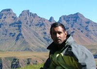
Serious tribe wrote: Do you have any images of the vertiginous section to get to Roland Cave with a person moving along it to show scale? Anyone else?
This is the best shot I've got of the Roland's access ledge. The cave itself is behind me in the photo (we were leaving the cave in the morning).
Please login or register to view the image attached to this post.
Please Log in or Create an account to join the conversation.
Stijn wrote:
Serious tribe wrote: Do you have any images of the vertiginous section to get to Roland Cave with a person moving along it to show scale? Anyone else?
This is the best shot I've got of the Roland's access ledge. The cave itself is behind me in the photo (we were leaving the cave in the morning).
Hmmm.
Ice on them thaar rocks??
Please Log in or Create an account to join the conversation.
- SeriousTribe2
-

- Offline
- Elite Member
-

- Posts: 211
- Thank you received: 25
