
Thumb Pass
02 Sep 2013 05:27 #58324
by ghaznavid
Its not mine, but its one of those really small ones. I doubt its particularly accurate.
Replied by ghaznavid on topic Thumb Pass
Serious tribe wrote: What wind gauge do you have?
Its not mine, but its one of those really small ones. I doubt its particularly accurate.
Please Log in or Create an account to join the conversation.

02 Sep 2013 06:04 #58325
by Josh of the Bushveld
Replied by Josh of the Bushveld on topic Thumb Pass
Scary experience
Please Log in or Create an account to join the conversation.
- Josh of the Bushveld
-
- Offline
- Platinum Member
-

Less
More
- Posts: 349
- Thank you received: 60
20 Oct 2013 06:50 #58829
by ghaznavid
Replied by ghaznavid on topic Thumb Pass
So Kliktrak, Hobbit and myself had a shot at this one again yesterday (as a day hike) - much like Popple Peak a few years ago, it seems this pass is out to get me 
We went up Langies as planned. It was very wet, raining and there was thick mist. We planned to find the top of Thumb Pass in the mist, or use one of the Hlubi's if we couldn't find it. We got to the top, sat down to have lunch - Hobbit started complaining that he wasn't feeling well - some form of stomach ache, but we couldn't figure out what the problem was so we started heading back down Langies. After a short while we realised he had hypothermia. We got him down to 2750m, out of the cold wind, and got him into some warmer clothes and he was back to his normal self after a few minutes. That part was not a pleasant experience at all.
Somehow I do have quite a few photos, but all are in thick mist, so not much to see. The Bushman's River is much fuller than it was when I was there a few weeks ago.
I had hoped to check out "This" Cave along the way, but the mist was too thick, so I couldn't see where it was. I did check out 2 other possible caves at around 2800m on the pass (they didn't look promising, but I still thought it was worth checking it out), one had a flattish sleeping area for 1 or 2 people curled up into a ball (probably 1mX1m) - but it was sopping wet. The other was not even a real overhang, you would struggle to sit in it, never mind sleep in it. In summary neither feature would be of any use, aside from maybe the further one in some sort of emergency, and only if it hadn't been raining recently.
Please Log in or Create an account to join the conversation.
18 Jan 2014 20:41 #59448
by ghaznavid
Replied by ghaznavid on topic Thumb Pass
I'll do a proper writeup on Thumb Pass some time soon.
But to summarise the events of today:
- Myself and Hobbit actually got up Thumb Pass. Thick mist, heavy erosion and I think some of the locals may be using the route - and that doesn't even cover half of what happened...
- Having somehow got to the top we decided to see how fast we could get down Langies, from the summit cairn to the waterfall took us 22m58
- 2h48 from the summit cairn of Langies to the car park, a personal record.
Ps. if you really want to do this pass you may need to get a brain scan - it may have been alright in clear weather, but its a combo of really easy, 2 tricky rock scrambles and a large grass bank with terrible exposure. It tops out at 3044m, almost at the top of Thumb Spur Peak.
Not sure if we used the same line as Intrepid's, but we did get up. There is also a 12 sleeper cave near the top.
Please Log in or Create an account to join the conversation.
19 Jan 2014 14:36 - 19 Jan 2014 16:20 #59450
by ghaznavid
Replied by ghaznavid on topic Thumb Pass
Mist seems inevitable
Thumb Pass has been on my mind for more than a year now. An objective I set myself a while back was to do every pass at Giants Castle, and to identify as many unopened/unrecorded passes as possible. This objective saw me identifying 3 different gullies which I have done – the 2 Hlubi passes and Gypaetus Pass. I have further spotted 4 gullies for exploration – I know the “projects” as Katana Pass (gully south of Katana peak), 007 Pass (the gully between Bond as per Bill Barnes and Bond as per the Geomaps), Popple Pass (aka Gypaetus north gully) and Auditor Pass (between Auditor and Witness).
It took me a while to figure out where Thumb Pass may be – after all, my early analyses of the Giants Castle region never even picked it up. After numerous studies of photos, Google Earth, maps etc I eventually figured out that there is a gully north of Thumb Spur Peak that leads to a spot near the top of Thumb Spur Peak – but the mystery to me was how to get from here to the escarpment.
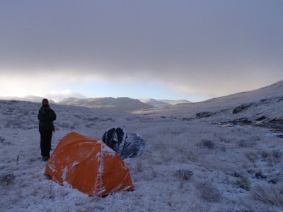
In February 2013 I had set out to do Thumb Pass, but upon reaching the contour path we headed up Langies instead due to thick mist – a decision that, as I write this, I know was the correct call. On this trip we had decided we would try to find the pass from the top and hike back down. I got some helpful photos, but we couldn’t find a summit gully north of the Thumb.
In 2013 on 2 other occasions I set out from the car park to climb the pass – the first time we turned around at about 2100m in a gale force wind we could not stand up in, the second time we tried to find the summit gully from the top, but thick mist and hypothermia by a team member forced us to head back down Langies. So, in total, 3 attempts at this pass, 3 additional times on Langies and no certainty as to how to find the summit of the pass.
My research had told me that the only possible route would be to follow the gully till the spur below Thumb Spur Peak, and then find a traverse ledge from there to the escarpment on the south side of the peak.
So, on Thursday around midday I decided I was going to go hiking this weekend. Put out a call for hikers on various channels, got 3 replies, but in the end only 1 taker.
So myself and Hobbit set out from Giant’s Castle car park. We left the car park at 7:15, our packs where about 5kg total (including water and the empty weight of the pack). We reached the tarn at around 9, and had reached the turnoff of the pass at about 9:30. The base of the pass is the first river that the contour pass crosses north of the Bannerman Path Tarn (seeing as it is unnamed I always call it “Tarn Tarn” – long story). We decided to turn off early to avoid losing altitude as the path drops toward the river we were about to climb.
We gradually gained altitude and progressively worked toward the main river. There are plenty of branches on the river. We could not see above 2600m, so we were not entirely sure we were in the right place, but as it turned out we were.
The true left bank is less rocky and more gently sloped, so we remained on this side. The pass is very gentle till at least 2750m – but once you begin to reach cliffs it becomes as steep as you would expect on any other pass.
The multiple rivers all converge on one point and then cease in a relatively wide (around 10m) gap between the cliffs. This is followed for a while before it briefly opens up, and then becomes a very narrow.
At the top of the open stretch there is a massive cave. It isn’t very deep, but it is very long. The roof becomes very high very quickly, but there is more than enough sleeping space for 12 people. The cave is at 29°16’24.7”S 29°26’30.0E 2957m (WGS84).
This narrow gully is probably about 3m wide. There is a grassy ledge right against the cliffs. In places it is really badly eroded. Along the way up there are also places where there is a faint path – with how bad the erosion at the top is I am wondering if locals haven’t started using this pass.
On the really eroded part Hobbit dislodged a soccer ball sized rock and I had to jump out of the way of it – there is plenty of loose scree and even unstable large rocks from about 2800m up. You need to be very careful. At one point I had dislodged a boulder that was at least 65cm across on the larger side.
The narrow gully has 2 blockages – both are about 2m high. The first can be climbed up the middle or to the right – but seeing as it looked unstable we opted for the right. The “crux” move on it is a right foot up to a small hold, left hand on an iffy push (kind of a balance move), step up partially on the right and go for a good jug with the right hand – full stand on right leg and get the left leg up (basically a swinging gate move). Your left hand only has grass or loose rocks to pull up. It’s not a pretty move, and with the loose steep nature of what is below you, I wouldn’t want to fall! It wouldn’t be nice to downclimb this bit.
The 2nd obstruction is much easier to negotiate, but is more loose and has some awkwardly placed thorns. We both managed these obstacles with our packs on, but if we had heavy packs I think we would have had to pass them up.
Just above the 2nd obstruction the gully opens out onto a large ledge. It is highly depressing to reach this point. My GPS said we were at 3029m, 45 flat metres from Thumb Spur Peak. Looking north there is a ledge that one might mistake for the summit ledge – it is very steep and exposed, and from my photos of the north side I knew this becomes a cliff.
In front of us was a large wall – looks like about a grade 12 climb. Curiously there was a very clear trail from the top of the gully to a very narrow ledge (not as wide as the Rolands Cave ledge). We decided to sit here for lunch, but I did not feel like eating – knowing my completion of Thumb Pass was so close yet so far. We knew where we were, we knew where we wanted to be, we just needed to figure out how to get there. The thick mist wasn’t helping either.
After a few minutes in which I neither ate nor drank anything, we started moving again. We dropped about 20m in altitude on the south slopes of the spur. Once we were below the cliffs and had a misty abyss below us – on a steep grassy slope that seems to be above a cliff we traversed past some rock scrambles till we found an easy scramble up. We got up the bottom part of this quite easily, but it soon became a near vertical grass slope. Unlike most grassy slopes the grass was a mass with no discernible tuft splits to get ones feet behind. I grabbed grass with both hands and basically smeared up the grass. With the exposure and possible large fall down the steep slope above a cliff I would really not like to climb down this pass.
From the top of this we scrambled up a much easier route to a saddle at 29°16’27.9S 29°26’25.6”E 3044m – basically at the summit of the nearby khulu.
So we had reached the top of Thumb Pass. I rate it a 4R/10* (i.e. relatively easy, Rock - as opposed to "rock" and "ROCK", and not a good quality route) - but I must say that this pass needs a warning. If you are not 100% clear on the route, do not attempt it. I also would be weary of using it as a way down.
From there we had a proper lunch break at the top. Seeing as we were about to do Langies for my 9th time and Hobbit’s 7th (3 of which were on prior attempts to find Thumb Pass), we decided to see if we could beat our previous record on the pass. After Gypaetus Pass we got down the pass in just under an hour. We were not planning on running down the pass, just not stopping and walking fast on the flat and less eroded parts of the route. Standing at the summit cairn I started a timer, I stopped it at the waterfall that marks the end of the actual pass. 22min58 for a pass – not too bad. Our target was 25 min, so I was happy with the time.
We took a break at the waterfall and then pushed through to the car park. From the top of Thumb Pass to the car park took 2h48, from the summit cairn to the car was 2h36 once again, a personal record.
Total distance: 21km (10km from the picnic site to the top of the pass)
Total photos: 60 - due to the mist
Total altitude gained: 1.4km
Thumb Pass has been on my mind for more than a year now. An objective I set myself a while back was to do every pass at Giants Castle, and to identify as many unopened/unrecorded passes as possible. This objective saw me identifying 3 different gullies which I have done – the 2 Hlubi passes and Gypaetus Pass. I have further spotted 4 gullies for exploration – I know the “projects” as Katana Pass (gully south of Katana peak), 007 Pass (the gully between Bond as per Bill Barnes and Bond as per the Geomaps), Popple Pass (aka Gypaetus north gully) and Auditor Pass (between Auditor and Witness).
It took me a while to figure out where Thumb Pass may be – after all, my early analyses of the Giants Castle region never even picked it up. After numerous studies of photos, Google Earth, maps etc I eventually figured out that there is a gully north of Thumb Spur Peak that leads to a spot near the top of Thumb Spur Peak – but the mystery to me was how to get from here to the escarpment.
In February 2013 I had set out to do Thumb Pass, but upon reaching the contour path we headed up Langies instead due to thick mist – a decision that, as I write this, I know was the correct call. On this trip we had decided we would try to find the pass from the top and hike back down. I got some helpful photos, but we couldn’t find a summit gully north of the Thumb.
In 2013 on 2 other occasions I set out from the car park to climb the pass – the first time we turned around at about 2100m in a gale force wind we could not stand up in, the second time we tried to find the summit gully from the top, but thick mist and hypothermia by a team member forced us to head back down Langies. So, in total, 3 attempts at this pass, 3 additional times on Langies and no certainty as to how to find the summit of the pass.
My research had told me that the only possible route would be to follow the gully till the spur below Thumb Spur Peak, and then find a traverse ledge from there to the escarpment on the south side of the peak.
So, on Thursday around midday I decided I was going to go hiking this weekend. Put out a call for hikers on various channels, got 3 replies, but in the end only 1 taker.
So myself and Hobbit set out from Giant’s Castle car park. We left the car park at 7:15, our packs where about 5kg total (including water and the empty weight of the pack). We reached the tarn at around 9, and had reached the turnoff of the pass at about 9:30. The base of the pass is the first river that the contour pass crosses north of the Bannerman Path Tarn (seeing as it is unnamed I always call it “Tarn Tarn” – long story). We decided to turn off early to avoid losing altitude as the path drops toward the river we were about to climb.
We gradually gained altitude and progressively worked toward the main river. There are plenty of branches on the river. We could not see above 2600m, so we were not entirely sure we were in the right place, but as it turned out we were.
The true left bank is less rocky and more gently sloped, so we remained on this side. The pass is very gentle till at least 2750m – but once you begin to reach cliffs it becomes as steep as you would expect on any other pass.
The multiple rivers all converge on one point and then cease in a relatively wide (around 10m) gap between the cliffs. This is followed for a while before it briefly opens up, and then becomes a very narrow.
At the top of the open stretch there is a massive cave. It isn’t very deep, but it is very long. The roof becomes very high very quickly, but there is more than enough sleeping space for 12 people. The cave is at 29°16’24.7”S 29°26’30.0E 2957m (WGS84).
This narrow gully is probably about 3m wide. There is a grassy ledge right against the cliffs. In places it is really badly eroded. Along the way up there are also places where there is a faint path – with how bad the erosion at the top is I am wondering if locals haven’t started using this pass.
On the really eroded part Hobbit dislodged a soccer ball sized rock and I had to jump out of the way of it – there is plenty of loose scree and even unstable large rocks from about 2800m up. You need to be very careful. At one point I had dislodged a boulder that was at least 65cm across on the larger side.
The narrow gully has 2 blockages – both are about 2m high. The first can be climbed up the middle or to the right – but seeing as it looked unstable we opted for the right. The “crux” move on it is a right foot up to a small hold, left hand on an iffy push (kind of a balance move), step up partially on the right and go for a good jug with the right hand – full stand on right leg and get the left leg up (basically a swinging gate move). Your left hand only has grass or loose rocks to pull up. It’s not a pretty move, and with the loose steep nature of what is below you, I wouldn’t want to fall! It wouldn’t be nice to downclimb this bit.
The 2nd obstruction is much easier to negotiate, but is more loose and has some awkwardly placed thorns. We both managed these obstacles with our packs on, but if we had heavy packs I think we would have had to pass them up.
Just above the 2nd obstruction the gully opens out onto a large ledge. It is highly depressing to reach this point. My GPS said we were at 3029m, 45 flat metres from Thumb Spur Peak. Looking north there is a ledge that one might mistake for the summit ledge – it is very steep and exposed, and from my photos of the north side I knew this becomes a cliff.
In front of us was a large wall – looks like about a grade 12 climb. Curiously there was a very clear trail from the top of the gully to a very narrow ledge (not as wide as the Rolands Cave ledge). We decided to sit here for lunch, but I did not feel like eating – knowing my completion of Thumb Pass was so close yet so far. We knew where we were, we knew where we wanted to be, we just needed to figure out how to get there. The thick mist wasn’t helping either.
After a few minutes in which I neither ate nor drank anything, we started moving again. We dropped about 20m in altitude on the south slopes of the spur. Once we were below the cliffs and had a misty abyss below us – on a steep grassy slope that seems to be above a cliff we traversed past some rock scrambles till we found an easy scramble up. We got up the bottom part of this quite easily, but it soon became a near vertical grass slope. Unlike most grassy slopes the grass was a mass with no discernible tuft splits to get ones feet behind. I grabbed grass with both hands and basically smeared up the grass. With the exposure and possible large fall down the steep slope above a cliff I would really not like to climb down this pass.
From the top of this we scrambled up a much easier route to a saddle at 29°16’27.9S 29°26’25.6”E 3044m – basically at the summit of the nearby khulu.
So we had reached the top of Thumb Pass. I rate it a 4R/10* (i.e. relatively easy, Rock - as opposed to "rock" and "ROCK", and not a good quality route) - but I must say that this pass needs a warning. If you are not 100% clear on the route, do not attempt it. I also would be weary of using it as a way down.
From there we had a proper lunch break at the top. Seeing as we were about to do Langies for my 9th time and Hobbit’s 7th (3 of which were on prior attempts to find Thumb Pass), we decided to see if we could beat our previous record on the pass. After Gypaetus Pass we got down the pass in just under an hour. We were not planning on running down the pass, just not stopping and walking fast on the flat and less eroded parts of the route. Standing at the summit cairn I started a timer, I stopped it at the waterfall that marks the end of the actual pass. 22min58 for a pass – not too bad. Our target was 25 min, so I was happy with the time.
We took a break at the waterfall and then pushed through to the car park. From the top of Thumb Pass to the car park took 2h48, from the summit cairn to the car was 2h36 once again, a personal record.
Total distance: 21km (10km from the picnic site to the top of the pass)
Total photos: 60 - due to the mist
Total altitude gained: 1.4km
Last edit: 19 Jan 2014 16:20 by ghaznavid.
The following user(s) said Thank You: JonWells
Please Log in or Create an account to join the conversation.
19 Jan 2014 14:47 #59451
by firephish
Replied by firephish on topic Thumb Pass
congrats on finally getting it! sounds like one to be avoided 
Please Log in or Create an account to join the conversation.
19 Jan 2014 14:56 #59452
by ghaznavid
Thanks. Pretty much - happy I've done it, but not planning on doing it again. I definitely wouldn't recommend it to most people...
Replied by ghaznavid on topic Thumb Pass
firephish wrote: congrats on finally getting it! sounds like one to be avoided
Thanks. Pretty much - happy I've done it, but not planning on doing it again. I definitely wouldn't recommend it to most people...
Please Log in or Create an account to join the conversation.
19 Jan 2014 15:03 - 19 Jan 2014 15:06 #59453
by ghaznavid
Replied by ghaznavid on topic Thumb Pass
I'll post photos from the route shortly - but here are some to show the route from previous trips:
The part of the pass before the narrow gully. You can see how long the cave is. Not very deep, but goes on forever, not sure how useful it is after the first 50m though. The white line is where the part where the gully disappears behind Thumb Spur Peak.
The gully to the spur near the top.
The route from the top of the spur to the summit. The lighting is bad, so you can't really see the grassy bits - but you can see the exposure. Note that the above photos are looking from north of Thumb Spur Peak, this is from the south. The line disappears behind the buttress to the left - hence the line going over a cliff
Please login or register to view the images attached to this post.
Last edit: 19 Jan 2014 15:06 by ghaznavid.
Please Log in or Create an account to join the conversation.
19 Jan 2014 15:09 - 19 Jan 2014 15:22 #59454
by ghaznavid
The base of the pass from just above the contour path.
The pass is not at all steep until you get quite far up.
Looking down just before we entered the mist.
The first section where the pass becomes relatively narrow.
Looking down the first throat of the pass.
Taking the idea from the spot on Mnweni Pass where everyone takes a photo. Gives you an idea of how thick the mist was...
Thumb Cave from right by its furthest edge.
Looking down the pass from just above Thumb Cave.
The pass becoming narrow.
Looking down the narrow bit.
One of the very eroded spots on the pass.
The top scramble - right near the top of the gully.
Couldn't get a nice outline of it - but this blob is Thumb Spur Peak. Photo taken at 3029m.
The grass ledge we had to climb down on the south slope of Thumb Spur.
I didn't get a photo on the really exposed bit - no safe spots to stop for a photo on it. The highest blob is Thumb Spur Peak once again.
Hobbit at the top of the pass.
Replied by ghaznavid on topic Thumb Pass
The base of the pass from just above the contour path.
The pass is not at all steep until you get quite far up.
Looking down just before we entered the mist.
The first section where the pass becomes relatively narrow.
Looking down the first throat of the pass.
Taking the idea from the spot on Mnweni Pass where everyone takes a photo. Gives you an idea of how thick the mist was...
Thumb Cave from right by its furthest edge.
Looking down the pass from just above Thumb Cave.
The pass becoming narrow.
Looking down the narrow bit.
One of the very eroded spots on the pass.
The top scramble - right near the top of the gully.
Couldn't get a nice outline of it - but this blob is Thumb Spur Peak. Photo taken at 3029m.
The grass ledge we had to climb down on the south slope of Thumb Spur.
I didn't get a photo on the really exposed bit - no safe spots to stop for a photo on it. The highest blob is Thumb Spur Peak once again.
Hobbit at the top of the pass.
Please login or register to view the images attached to this post.
Last edit: 19 Jan 2014 15:22 by ghaznavid.
Please Log in or Create an account to join the conversation.
19 Jan 2014 22:04 - 19 Jan 2014 22:05 #59455
by ghaznavid
Replied by ghaznavid on topic Thumb Pass
I found a better photo to depict the section of the pass from 3029m on the spur to the escarpment. Always funny to look at how un-exposed a section looks in a photo...
Ps. where it looks like we are walking through cliffs it is just the angle, there was very little rock involved in this bit - some solid rock would have made it feel safer/easier...
Ps. where it looks like we are walking through cliffs it is just the angle, there was very little rock involved in this bit - some solid rock would have made it feel safer/easier...
Please login or register to view the image attached to this post.
Last edit: 19 Jan 2014 22:05 by ghaznavid.
The following user(s) said Thank You: Selous
Please Log in or Create an account to join the conversation.
