
Mafadi loop - Corner Pass NHA and Leslies Pass
07 Jan 2015 17:26 - 12 Jan 2015 12:54 #62537
by Smurfatefrog
Mafadi loop - Corner Pass NHA and Leslies Pass was created by Smurfatefrog
On Saturday 3 January five of us set off to conquer Mafadi. The 4 Durban guys; myself, Jon (JonWells), Ian (Bos) and Simon (Fitness) were joined by Wesley (Wezleyb) who had come down from JHB to meet us at Injisuthi. Having read up on groups going off track on route to Centenery Hut and upstream of Marble Baths I made sure I had all the data necessary, and also importantly the NHA route to Corner Pass in case we had to ascend in thick mist. Sabine kindly gave me her full track of the exact route we were planning.
Day 1 – Injisuthi Camp to Centenery Hut – 12km
We set off around 9am on a hot and muggy day. Our first decision was whether to do the Injisuthi river crossing or take the Poachers stream path which is about 1km longer. The river didn’t look too bad from the road so we decided to try the river crossing. We got there to see a group of young hikers making their way back, it seemed manageable so we took our boots off and headed across. The current in the main channel was very strong and about thigh high. Simon lost his balance for a second and scooped up a cup or two of water in his boots, but otherwise we got across safely.
We were all starting to feel the heat after a few KMs, but once we took the left split to go up the Mbovaneni river it became almost unbearable in the long grass. Wesley especially was not used to the KZN heat so did a bit of bush wacking to have a quick dip in the river to cool off, we stopped again about a kilometre further by Fergys cave to cool off and have a snack, I had a very melted Bar One!
As we were sitting there we heard rumbling of thunder in the distance and had a few drops of rain, cold rain on our heads didn’t actually seem too bad at the time. From just after the cave there are 2 paths to the bottom of “Heartbreak Hill”, the one to the right is sightly more direct but goes over an unnecessary ridge, we were in no mood to climb altitude only to lose it again so we stuck to the path that followed the river. We were glad the temperature had dropped quite a bit at this point as we headed slowly up the gruelling hill. A few more threatening raindrops got our rain jackets and pack covers on but it didn’t amount to much.
Heartbreak hill about halfway up
We arrived at Centenery hut around 14:30, the hut was better than I had expected. Jon slept on a bed while the rest of us decided to use the floor with our mattresses. Ian from “Drakensberg Hiker” and a group arrived a few minutes after us (my 2nd hike in a row I had seen them), they set up tents outside. It wasn’t even 20 minutes after we arrived when rain started, then hail, then more rain, and more and more. It poured down for about an hour. Suddenly the escarpment had water flowing off everywhere. The temperature dropped to 10°C during the storm. We were then greeted with a cool clear night, a bit of a breeze picked up but nothing too serious.
Before the storm
Water and ice collection
After the storm (note the 2 falls for day 3)
Day 2 – Centenery Hut to Upper Injisuthi Cave – 13km
We woke up to a clear morning and set off just after 7, heading up to the contour path and then directly up the slope to start the Northern High Approach of Corner Pass. The first slope is a bit vague due to people zig zagging up here but it’s easy enough to follow.
After this section there is a strong path the whole way. We got to the scramble section to find it extremely wet and slippery, the good thing was that we could fill our water bottles up here, the bad thing was that it was a lot more difficult than we expected. Myself and Wesley managed to get up with our backpacks on, the other guys had larger packs and getting around a particular rock proved dangerous with them on, so we hauled the other 3 packs up with rope. The second part of the scramble had a stream running across it, but it was easily passed although the exposure was a bit worse here.
Heading towards the rockband
Wesley and Ian tackle the scramble, it looks easier than it is
Please login or register to view the images attached to this post.
Last edit: 12 Jan 2015 12:54 by Smurfatefrog.
Please Log in or Create an account to join the conversation.
- Smurfatefrog
-
 Topic Author
- Offline
- Moderator
-

Less
More
- Posts: 1132
- Thank you received: 1550
07 Jan 2015 17:39 - 12 Jan 2015 13:30 #62538
by Smurfatefrog
Replied by Smurfatefrog on topic Mafadi loop - Corner Pass NHA and Leslies Pass
We continued along heading south until we got to the Corner Pass gully, the alternate path going across the gully on the south side is clearly visible. We quickly entered the narrow gully section and were confronted by the first obstacle, everyone climbed up here fairly easily but we did haul a couple packs up again, 80+litre packs are not a great idea on Corner Pass.
There were a couple other minor obstacles which were no problem, then we got to the final obstacle right near the top… It was an actual waterfall, so yes we had water on the pass all the way to the top! The waterfall itself was very wet and slippery, I decided to try the grass slope on the right. It involved 2 huge step ups, each about a metre high, I grabbed a huge tuft of grass in each hand and pulled myself up hoping the grass held, which thankfully it did. It then proved a little tricky getting around the rock on the right with my pack on but I managed to wiggle sideways and get to the top. While I was doing this Wesley somehow managed to climb up the waterfall. Simon followed up the grass slope with his pack, he’s a bit shorter so had a few heart stopping moments on the big step ups. We then hauled Jon and Ian’s huge packs up and they also climbed the grass slope. We all found the scramble on the NHA rock band and this last obstacle quite dangerous in the wet, I would not recommended doing this after heavy rains!
Relaxing after reaching the top
We had a break at the top of Corner Pass as the mist started to roll in. Wesley went off to check out the horses and sheep while a shepherd (Simon has named him Trevor) on his horse spotted us from across the valley and came to visit with his 4 dogs. He excitedly greeted us with a “Good morning”, his English was quite good and he just seemed to want to chat. He was very excited to get tuna from Simon and some sweets from the rest of us, he let us take some photos and upon seeing himself loudly exclaimed “I’m beautiful”. We said out goodbyes and headed off into the mist.
Check out his blanket
We all popped up the few metres to Corner Peak (3195m), nothing to see though in the mist. We had planned to summit Trojan Wall today but decided it was pointless in the mist, so we headed for the low point on the ridge between Trojan Wall and Injisuthi Dome, it was a long climb all the way to 3320m. At about 3300m we saw our 4th snake for the day, a combination of berg adders and skaapstekers. Every now and then the mist would clear for a few seconds to give us a view ahead but most of the time we were relying on the GPS. We found Upper Injisuthi Cave without any problems, as previously mentioned there is evidence of local usage but it wasn’t as bad as I expected. The cave is however extremely dusty. All the rain the previous afternoon had meant there was a drip in the middle of the main front sleeping area, but it also meant we didn’t need to go down to the river with all the drips and trickles around the rockband. It stayed misty into the night with only brief glimpses of the triplets in front of us.
Day 3 – Upper Injisuthi Cave to Marble Baths – 21km
This cave is an awesome place to wake up in
We woke up to a crisp clear morning at 7.9°C, I ventured down to the escarpment edge to get some closer views of the Triplets and the unnamed waterfall just north of the Trojan Wall that we had seen from the hut.
The two waterfalls as seen from Centenery Hut
Looking back up to the cave
Please login or register to view the images attached to this post.
Last edit: 12 Jan 2015 13:30 by Smurfatefrog.
The following user(s) said Thank You: Captain
Please Log in or Create an account to join the conversation.
- Smurfatefrog
-
Topic Author
- Offline
- Moderator
-
Less
More
- Posts: 1132
- Thank you received: 1550
07 Jan 2015 17:58 - 10 Jan 2015 12:07 #62539
by Smurfatefrog
Replied by Smurfatefrog on topic Mafadi loop - Corner Pass NHA and Leslies Pass
The northern falls with the Corner and Judge in the background
I dragged myself back up to the cave to pack up before we headed off for our first goal of the day, Trojan Wall (3354m). We were greeted by some amazing views of about 15 lammergeiers below us.
8 lammergeiers in this pic
The grass must be tasty at 3350m
Next stop, Injisuthi Dome (3410m), then our main goal of Mafadi (3450m). It was quite windy on the roof of SA so we had a break behind the rockband before setting off for Leslies Pass.
I was quite keen to climb the two buttresses but when I saw we’d need to descend over 200m I settled for more distant views. We were walking about 15m below Lithobolong Peak (3375m) so I quickly went up to make it 4 of SA’s highest 6 peaks for the day. As we headed north and to the escarpment edge we had amazing views of the buttresses, triplets, Red Wall Falls and the Buttress Fork stream falls.
From near to far: Buttress Fork stream falls, Greater Injisuthi Buttress, Lesser Injisuthi Buttress, Hilton Pass, with Red Wall Falls just visible and Red Wall Peak to the upper right, Trojan Wall and Injisuthi Dome at the back with Corner Peak peering over
We had a short break at the top of Leslies Pass, but soon started the descent with the sun beating down on us. The first half of the pass is very steep and full of scree and loose gravel, we all made it down without issues to the river where we had a short break.
Top of Leslies Pass
Scree fields
No shortage of water
The path is clear the whole way with plenty of cairns. The pass finishes off going down the extremely steep nose of the ridge. We reached the campsite at 14:00, our original plan was to camp here but had decided to push for Marble Baths to leave us a shorter 4th day. Again our break was cut short by us wanting to get out of the hot sun so we set off into the maze… We again used Sabine’s track in combination with cairns and paths, the track differed in some spots where I assume there are different paths. In total we were probably on a “path” for 90% of the 3.5km but it still took us 2h15. We had a short break about half way where myself and Jon were feeling very dehydrated, I drank about a litre of USN and trudged on. The numerous river crossings were also time consuming looking for the best places to triple jump across!
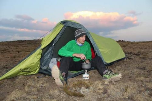
We were all relieved to finally reach the Marble Baths campsite (we might as well use the tents we were carrying), it took us about 2 minutes to throw our packs down, take off sweaty clothes and run down to jump into the pools, sooo refreshing after a long day in the heat, the knees and feet were not thanking us for descending 1700m that day! We enjoyed a warm night by the river, even getting surrounded by “miggies” and a few mosquitos.
I dragged myself back up to the cave to pack up before we headed off for our first goal of the day, Trojan Wall (3354m). We were greeted by some amazing views of about 15 lammergeiers below us.
8 lammergeiers in this pic
The grass must be tasty at 3350m
Next stop, Injisuthi Dome (3410m), then our main goal of Mafadi (3450m). It was quite windy on the roof of SA so we had a break behind the rockband before setting off for Leslies Pass.
I was quite keen to climb the two buttresses but when I saw we’d need to descend over 200m I settled for more distant views. We were walking about 15m below Lithobolong Peak (3375m) so I quickly went up to make it 4 of SA’s highest 6 peaks for the day. As we headed north and to the escarpment edge we had amazing views of the buttresses, triplets, Red Wall Falls and the Buttress Fork stream falls.
From near to far: Buttress Fork stream falls, Greater Injisuthi Buttress, Lesser Injisuthi Buttress, Hilton Pass, with Red Wall Falls just visible and Red Wall Peak to the upper right, Trojan Wall and Injisuthi Dome at the back with Corner Peak peering over
We had a short break at the top of Leslies Pass, but soon started the descent with the sun beating down on us. The first half of the pass is very steep and full of scree and loose gravel, we all made it down without issues to the river where we had a short break.
Top of Leslies Pass
Scree fields
No shortage of water
The path is clear the whole way with plenty of cairns. The pass finishes off going down the extremely steep nose of the ridge. We reached the campsite at 14:00, our original plan was to camp here but had decided to push for Marble Baths to leave us a shorter 4th day. Again our break was cut short by us wanting to get out of the hot sun so we set off into the maze… We again used Sabine’s track in combination with cairns and paths, the track differed in some spots where I assume there are different paths. In total we were probably on a “path” for 90% of the 3.5km but it still took us 2h15. We had a short break about half way where myself and Jon were feeling very dehydrated, I drank about a litre of USN and trudged on. The numerous river crossings were also time consuming looking for the best places to triple jump across!
We were all relieved to finally reach the Marble Baths campsite (we might as well use the tents we were carrying), it took us about 2 minutes to throw our packs down, take off sweaty clothes and run down to jump into the pools, sooo refreshing after a long day in the heat, the knees and feet were not thanking us for descending 1700m that day! We enjoyed a warm night by the river, even getting surrounded by “miggies” and a few mosquitos.
Please login or register to view the images attached to this post.
Last edit: 10 Jan 2015 12:07 by Smurfatefrog.
Please Log in or Create an account to join the conversation.
- Smurfatefrog
-
Topic Author
- Offline
- Moderator
-
Less
More
- Posts: 1132
- Thank you received: 1550
07 Jan 2015 18:11 #62540
by Smurfatefrog
Replied by Smurfatefrog on topic Mafadi loop - Corner Pass NHA and Leslies Pass
Day 4 –Marble Baths to Injisuthi Camp– 9km
We were up early and ready to get back for a burger and beer! We carried our boots across Marble Baths and got booted up and ready to leave at 6:30am.
We had managed to keep dry boots on a 4 day summer hike, a rare thing… unfortunately a couple of us got wet boots crossing the Injisuthi river at the T junction. We were thankful that we stayed out the sun most of the way back due to our early start. It was decided to take the Poachers stream path back to the road; the river was higher than on day 1 and our legs were not feeling up to taking on the current.
The last downhill
A last glimpse at where we were the day before
All in all an awesome 4 days in the berg! We finished off with a beer and snacks before heading off for that well deserved burger!
Total distance: 55km
72 hours in total (17.5 hiking, 9 stops, 45.5 camping/sleeping) So we were only 62 hours short of the Mafadi record, next time guys!
2800m altitude gain
I’ll leave it up to Fitness to post a pic of himself and his new mate.
Please login or register to view the images attached to this post.
The following user(s) said Thank You: Serious tribe, elinda, Stijn, kliktrak, firephish, ghaznavid, tonymarshall, Sabine, Captain, Dillon
Please Log in or Create an account to join the conversation.
- Smurfatefrog
-
Topic Author
- Offline
- Moderator
-
Less
More
- Posts: 1132
- Thank you received: 1550
07 Jan 2015 18:25 #62541
by Stijn
Replied by Stijn on topic Mafadi loop - Corner Pass NHA and Leslies Pass
Great report, thanks. Makes me want to get out there again!!
Please Log in or Create an account to join the conversation.

07 Jan 2015 18:28 #62542
by Smurfatefrog

Replied by Smurfatefrog on topic Mafadi loop - Corner Pass NHA and Leslies Pass
Your name came up quite a few times between the top of Leslies and Marble Baths, trying to imagine how you do it, we are still cluelessStijn wrote: Great report, thanks. Makes me want to get out there again!!
Please Log in or Create an account to join the conversation.
- Smurfatefrog
-
Topic Author
- Offline
- Moderator
-
Less
More
- Posts: 1132
- Thank you received: 1550
07 Jan 2015 18:47 #62543
by ghaznavid
Replied by ghaznavid on topic Mafadi loop - Corner Pass NHA and Leslies Pass
Thanks for sharing 
Got to love Lithabolong. SA's 4th highest peak and you could walk past it without known that it is even there...
Got to love Lithabolong. SA's 4th highest peak and you could walk past it without known that it is even there...
Please Log in or Create an account to join the conversation.

07 Jan 2015 18:54 #62546
by Fitness
Replied by Fitness on topic Mafadi loop - Corner Pass NHA and Leslies Pass
Thanks for the write Smurf, feel like I need to get back out there again, amazing how one quickly forgets the hard yards and remembers the best things.
My new mate "Trevor", what a legend
Having a look up from Marble Baths
Wes and Smurf at the top of Trojan Wall
Bos, JonWells, Smurfatefrog and WezleyB
Team taking a short stop just above the hut
My new mate "Trevor", what a legend
Having a look up from Marble Baths
Wes and Smurf at the top of Trojan Wall
Bos, JonWells, Smurfatefrog and WezleyB
Team taking a short stop just above the hut
Please login or register to view the images attached to this post.
The following user(s) said Thank You: Serious tribe, ghaznavid, Smurfatefrog, tonymarshall, Sabine, Captain, Dillon
Please Log in or Create an account to join the conversation.

07 Jan 2015 19:49 #62549
by Dillon
Replied by Dillon on topic Mafadi loop - Corner Pass NHA and Leslies Pass
Awesome guys, well done! That route (and the whole Injisuthi area!) holds a special place in my heart.
Please Log in or Create an account to join the conversation.
07 Jan 2015 20:06 #62550
by JonWells
Replied by JonWells on topic Mafadi loop - Corner Pass NHA and Leslies Pass
Thanks guys, that was a really epic mission!
Whilst the memories are fresh, and for the sake of anyone else attempting this route I will be very honest here and say that I did have 2 of my worst ever Berg experiences on this trip:
1- Climbing the rock band on the Northern high approach to Corner Pass was an EXTREMELY unpleasant affair. It would definitely be quite a challenge even in dry conditions, but most of the rock was very wet and slippery after all the recent rains, so climbing up involved desperately trying to find traction on elusive dry rock, and at times having to trust fistfulls of muddy grass to haul ourselves up. The rock band is also seriously high with a very steep grass bank below it, so we did feel rather exposed. A slip up here honestly could be disastrous. We really were all very shaken after getting to the top. A very scary experience! If you're a mere mortal hiker like us, I would strongly recommend not attempting this route during the wet season!
2- Bottom of Leslie's Pass to Marble baths. I'd read a lot of negative reports about this section, so was expecting it to be a bit of a challenge, I didn't expect it to be HELL! But thats exactly what it was after reaching the bottom of the pass on worn out wobly legs and a very tired brain. At this stage, all we wanted to do was set up camp and take our boots off. We knew that salvation lay a mere 3km away, well it felt more like thirty! In terribly hot and humid conditions we whacked our way through the bush "path", hitting dead end after dead end. We would wade through chest high bush, trip on hidden rocks, fall in holes, rinse, repeat. At times we would find ourselves in the riverbed where we were forced to hop from boulder to boulder which was unbearable when theres nothing left in the legs. Then we asked Smurf to check his GPS to see if we were almost there:
"We've only done 1km..."
DEEP BREATH! Try not to have a meltdown!
I think we were only barely sane when we finally slumped out the hell maze, and I certainly have no inclination to ever revisit that stretch again!
Aside from the above, it was fantastic to explore the Injisuthi escarpment, and finally bag Mafadi, so in the end there are no regrets!
The following user(s) said Thank You: elinda, firephish, ghaznavid, Smurfatefrog, Captain, Fitness, Richard Hunt
Please Log in or Create an account to join the conversation.

