Hike report Lotheni June 2011
20 Jun 2011 10:21 #3164
by MarkT
Hike report Lotheni June 2011 was created by MarkT
Hi all,
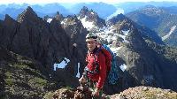
Day 1: We set off from Lotheni and took Eagle trail to the contour path, then headed to Hlatimba pass (south). Spent the first night in Hlatimba Cave (north).
Day 2: Up to Redi peak, along the top and over into the river valley near Ntubeni pass where we saw many Basothos and their herds, no problems though. Spent night #2 in Lotheni cave (finding it was easy thanks to the GPS coords from this forum!).
Day 3: Down Lotheni pass, the smugglers route. We then left their well-worn path that heads away from Lotheni and hopped along the river until we could meet up with the path that goes past Ash cave. This path is not in very good condition and we spent a lot of time on ankle-breaking slopes, it only gets decent near Yellowwood cave.
Thanks for the GPS database on this site, it's really great. If anyone wants a lightweight GPS system on the cheap, try this: Get a phone with a GPS on it running Android operating system (check out Samsung, HTC and ask around). Get an application called OSMand+ for R30 from the Android market, it can download all the terrain maps from Google Maps (excellent detail and contours) which can be used "offline" with the phone in "flight mode" (saves battery). The app can open the GPX files that are provided here on Vertical Endevour and plot them out on the terrain map along with your location.
The battery will last +-7 days in flight mode with infrequent use, hardly weighs anything, and gives you a lot of confidence that you're not going to get lost.
Day 1: We set off from Lotheni and took Eagle trail to the contour path, then headed to Hlatimba pass (south). Spent the first night in Hlatimba Cave (north).
Day 2: Up to Redi peak, along the top and over into the river valley near Ntubeni pass where we saw many Basothos and their herds, no problems though. Spent night #2 in Lotheni cave (finding it was easy thanks to the GPS coords from this forum!).
Day 3: Down Lotheni pass, the smugglers route. We then left their well-worn path that heads away from Lotheni and hopped along the river until we could meet up with the path that goes past Ash cave. This path is not in very good condition and we spent a lot of time on ankle-breaking slopes, it only gets decent near Yellowwood cave.
Thanks for the GPS database on this site, it's really great. If anyone wants a lightweight GPS system on the cheap, try this: Get a phone with a GPS on it running Android operating system (check out Samsung, HTC and ask around). Get an application called OSMand+ for R30 from the Android market, it can download all the terrain maps from Google Maps (excellent detail and contours) which can be used "offline" with the phone in "flight mode" (saves battery). The app can open the GPX files that are provided here on Vertical Endevour and plot them out on the terrain map along with your location.
The battery will last +-7 days in flight mode with infrequent use, hardly weighs anything, and gives you a lot of confidence that you're not going to get lost.
Please Log in or Create an account to join the conversation.


20 Jun 2011 11:36 - 20 Jun 2011 11:37 #3166
by JonWells
Replied by JonWells on topic Re: Hike report Lotheni June 2011
Hey MarkT, thanks for reporting back, and I will definitely be checking out OSMand+.
Did you guys have any issues finding water around the top of Hlathimbe Pass? I'd like to check out that area sometime soon.
Did you guys have any issues finding water around the top of Hlathimbe Pass? I'd like to check out that area sometime soon.
Last edit: 20 Jun 2011 11:37 by JonWells.
Please Log in or Create an account to join the conversation.

20 Jun 2011 11:42 #3167
by MarkT
Replied by MarkT on topic Re: Hike report Lotheni June 2011
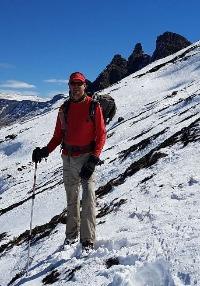
Hey Jon, we melted some ice, which kept us going until we got to the river system near Ntubeni pass. Would have been tough without the remains from the heavy snow!
Please Log in or Create an account to join the conversation.
20 Jun 2011 12:18 #3168
by ghaznavid
Replied by ghaznavid on topic Re: Hike report Lotheni June 2011
Sounds awesome! I'm jealous...
Please Log in or Create an account to join the conversation.


20 Jun 2011 19:00 #3174
by intrepid
Take nothing but litter, leave nothing but a cleaner Drakensberg.
Replied by intrepid on topic Re: Hike report Lotheni June 2011
Thanks for reporting back Mark, glad it all worked out. Agree: the Ash Cave trail is not the greatest. Nor is there a smooth connection between the base of Lotheni Pass and the cave.
@Jon: have camped at Hlatimba in late winter and in summer and haven't had an issue with water. There seems to be a pretty consistent stream behind the passes.
@Jon: have camped at Hlatimba in late winter and in summer and haven't had an issue with water. There seems to be a pretty consistent stream behind the passes.
Take nothing but litter, leave nothing but a cleaner Drakensberg.
Please Log in or Create an account to join the conversation.