Tsepeng Pass North

Seems everyone likes the middle gully - myself and Fitness took the south gully. We followed the south grassy slope which was steep, but not rocky. We had an exposed scramble in the gully. The pass was worthwhile but quite difficult I thought.
Please Log in or Create an account to join the conversation.

Please Log in or Create an account to join the conversation.
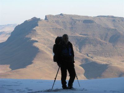
ok thanks, maybe visible in the right of this pic.ghaznavid wrote: We did the gully that isn't clearly visible between these two gullies. We did look up at that gully marked in red and wondered if it goes, but opted not to use it.
And Elinda's maybe in the middle of the pic, so many options....
Please login or register to view the image attached to this post.
Please Log in or Create an account to join the conversation.
- Smurfatefrog
-

- Away
- Moderator
-

- Posts: 1129
- Thank you received: 1541
(excuse the poor quality photo)
Please login or register to view the image attached to this post.
Please Log in or Create an account to join the conversation.
Revisiting the issue of more than one route in this valley: my current impression is that the Tsepeng Pass indicated on the Geomaps is probably the one that ghaznavid and co did (ie doing most of the main gully but then finishing off on a gully branching off on the true right). I haven't compared the various summit waypoint readings on a map though. Since this route and the yellow arrow route diverge fairly close to the top (and their summits are probably also not far from each other), I propose that these two routes be considered variations of each rather than totally separate passes.Smurfatefrog wrote: Reading this thread before this weekend confused me a little because Tony's write up did not match the waypoint or track I had, so there seems to be quite a few variations of Tsepeng Pass.
So far from what I can gather:
Tony, Intrepid & co did the main gully (yellow arrow)
Ghaz & Fitness did a gully just to the left of the yellow arrow
Elinda & co seem to have done the same as above
Myself & co did the red arrow (I had this as a waypoint & track, and it had a cairn)
This is looking down from the top at this spot -29.746380 29.136967
The top was very steep & narrow, and had a few scrambles with plenty of ice around.
Once out of the narrow gully we just made our way down the grass slopes to the main riverbed at 2630m
The red arrow route on the other hand, could be seen as a fairly separate pass and thus I propose that we refer to this one as Tsepeng Pass South. The other route and it's variation could be referred to as Tsepeng Pass North. Please let's have your thoughts and perhaps different suggestions on this, and if there are even more routes and variations in this valley let us know!
Take nothing but litter, leave nothing but a cleaner Drakensberg.
Please Log in or Create an account to join the conversation.

Please Log in or Create an account to join the conversation.
- Smurfatefrog
-
- Away
- Moderator
-
- Posts: 1129
- Thank you received: 1541
Please Log in or Create an account to join the conversation.

The same is true of the yellow route, which I descended on this same trip: there is lots of loose rock with evidence of recent rockfall. I did not feel comfortable staying in the gully. In fact, because of mist, I descended beyond the point I had previously used to exit onto the true right-hand grassy slopes (the safe route, in my view). If you stay in the gully, you come to the chockstone Tony refers to in a previous post , though from above this appears to be simply a very high drop-off, and I did not see an opening to the wormhole. The gully walls at this point are close to sheer, though there seems to be a narrow way round on the left on very steep slopes. But in poor weather I would regard this route as unsafe and highly recommend exiting higher up onto the true right-hand grassy slopes.Smurfatefrog wrote: Just a note on the red arrow route, we came down there a week ago and there are plenty loose rocks. Its a very narrow gully so there is nowhere to escape. We had a massive rock that was loose that you had to scamble down on, took us a while to go down carefully, pass packs and then get out the way before the next person went down.
Please Log in or Create an account to join the conversation.
- TheRealDave
-
- Offline
- Elite Member
-

- Posts: 195
- Thank you received: 256
Once through, we found ourselves on a small area of a flat boulder/chockstone(enough space for the three of us) with a steep drop off back into the main gully behind. We then carefully climbed up over the remaining curvature of the chockstone taking care not to slip(I remember this feeling quite exposed) and over some dodgy lose smaller chockstones creating the 'roof' of the cavity below. The going was fairly straight forward from then on continuing in the main gulley.
At the time, this seemed better than the steep grass slopes but it would have been difficult without the tall guy.
Coming down the pass it would be pretty difficult to locate the wormhole as it would be out of site and would require a fairly sketchy downclimb to find it and would probably require rope assistance to lower yourself through safely.
This was late 2016, so the details are a little fuzzy.
It would be interesting to see how a flash flood may have changed the accessibility of this route.
Please Log in or Create an account to join the conversation.
- GriffBaker
-

- Offline
- Elite Member
-
- Posts: 123
- Thank you received: 191
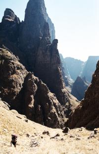
I have dug up some photos
Our approach above the upper main gully. From here we descended via a steep grassy gully in to the main gully itself
We bypassed a frozen waterfall by going on the left. I remember this as being very slippery!
We traversed to the left and back to Garden Castle via Sleeping Beauty
Please login or register to view the images attached to this post.
Please Log in or Create an account to join the conversation.