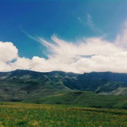
Judge Pass
Snow forecast for Friday, but it comes and goes...don't know what to expect!
Please Log in or Create an account to join the conversation.

Let me know if you would like the GPS track.
Cheers
Please Log in or Create an account to join the conversation.
- supertramp
-
- Offline
- Elite Member
-

- Posts: 229
- Thank you received: 467
supertramp wrote: Have done that section twice during the last year or so.
We've decided to night hike Thursday to Bannerman hut and then up Judge pass on Friday. Anything i need to watch out for at the pass itself? I looks like some rain for us and then snow higher up!
Does the pass have a good trail with cairns?
Please Log in or Create an account to join the conversation.

I haven't done this pass since late 2015, but the trail was very well defined (much better than the contour path) - you can't miss it. There is a small cairn marking the turnoff, but that is more for when you are coming down and might miss the contour path, seeing as the trail crosses the contour path and just keeps going.
My writeup with some photos is at www.vertical-endeavour.com/forum/drakensberg-trips/55926-injisuthi-dome-you-be-the-judge-part-2/
I think the pass is quite easy, but lots of people don't agree with me on this - I guess I have always done it with a light pack, which makes most passes quite easy [at Mnweni Marathon runners: when you see me struggling up Mnweni Pass on Saturday, please remind me that I said that]. Nonetheless - definitely one of the best passes in the Giants Castle region.
Please Log in or Create an account to join the conversation.


Just lastly...what time does te gate close at Giants and can we pay at the gate? We should be at Giants 21:30ish, probably start 22:00ish and be at Bannerman hut 01:30ish. Many ishes with the times, but all should be well!
Please Log in or Create an account to join the conversation.
Gudstff wrote: Just lastly...what time does te gate close at Giants and can we pay at the gate? We should be at Giants 21:30ish, probably start 22:00ish and be at Bannerman hut 01:30ish. Many ishes with the times

I've done that walk to Bannerman Hut in the dark a few times - it feels much longer!
I think it closes at 9, but give them a call and ask. The details should be on their website - including gate times (couldn't find it when I just checked, but they did have a phone number).
Please Log in or Create an account to join the conversation.
Thanks for your input! It's very helpful!
Please Log in or Create an account to join the conversation.
The night before we descended Judge Pass we had tented next to a stream near the top of the pass, and summited The Judge before descending the pass. Approaching the top of the pass from the north, there are two gullies, and the pass is in the southern one with the path. A view of the two gullies with Popple Peak in the background.
Looking down the northern gully, the path can be seen below in the southern gully. Photo courtesy of Lorinda.
The path into Judge Pass with the Popple ridge and Auditor in the background.
The path traverses at a flat gradient into the pass.
Near the end of the traverse where the steep descent starts.
The steep descent with zig zags near the top of the pass.
A view back up Judge Pass, which has a trail the whole way.
The path continues to zig zag down to the area where the two gullies join.
Please login or register to view the images attached to this post.
Please Log in or Create an account to join the conversation.
- tonymarshall
-

- Offline
- VE Advisory
-

- Posts: 773
- Thank you received: 2261
The path then exits the gully to the right, and flattens out a bit.
The path gains quite a lot of height above the stream below, and fortunately provides easy passage on the steep sideslope. Photo courtesy of Lorinda.
After the flattish section, the route gets steeper in the lower section of Judge Pass.
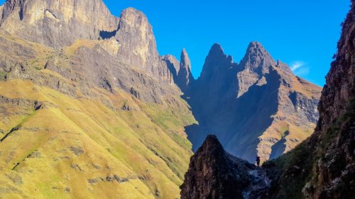
A view back up the steeper lower section of the pass, with the iconic shape of The Judge on the right.
The path then descends on the left of a small side gully (in the unburnt grass in the photo below). Photo courtesy of Lorinda.
Nearing the bottom of Judge Pass with the path below visible in the burnt grass and the Contour Path crossing the valley near the bottom of the slope of burnt grass. Photo courtesy of Lorinda.
A view back up Judge Pass from near the bottom of the pass. The pass follows the ridge at the centre of the photo between the burnt grass and the shadow on the right.
It is difficult to understand how Judge Pass was once regarded as a Rock Pass, as the current smugglers trail hardly even has any scrambles.
Since most hikers using Judge Pass will exit left or right at the bottom of the pass onto the Contour Path, be careful to look out for the Contour Path, which is easy to miss, as the main (smugglers) trail carries on directly down the valley.
Please login or register to view the images attached to this post.
Please Log in or Create an account to join the conversation.
- tonymarshall
-
- Offline
- VE Advisory
-
- Posts: 773
- Thank you received: 2261
tonymarshall wrote: It is difficult to understand how Judge Pass was once regarded as a Rock Pass, as the current smugglers trail hardly even has any scrambles.
I also wondered about that - with a day pack, that scramble doesn't even require your hands (unfortunately I didn't get a photo of it). My guess is that the map makers would rather mark a non-rock pass as rock than miss the label from an actual rock pass, so they simply use the label when they aren't sure.
Please Log in or Create an account to join the conversation.