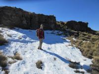
Uklebe Pass
intrepid wrote: The smugglers use Lotheni Pass, so go figure
They use the "South Fork" though, not the "North Fork" which is the one marked on the map (this one does indeed have a very nasty looking rock step in it). It doesnt make sense to me why the hikers decided on marking this one when the south fork is so obvious and not technically challenging. Anyway, the smugglers (and rustlers) figured it out and you can walk on their trail. The trail wont take you to Ash Cave though, you have leave it an arbitary point and bundu bash the rest. Do this early enough though (ie higher up). We left the trail to late and really struggled to descend the valley slopes to get to Ash Cave.
Awesome

That raises a different question then - is Lotheni Cave a safe overnight spot?
Quite honestly, overnight hiking in winter isn't overly appealing to me when compared to the beautiful green (but misty) summer hikes. But seeing as security is better in winter, and Lotheni is dodgy for security, that's the cause for the timing. I also would probably get lost on Uklebe Pass if there was mist around.
intrepid wrote: Ash Cave is pretty good, not too deep but works well enough. It was welcome relief from the wind and rain pelting us at the time. Yellowwood Cave is not that deep, but its in a yellowwood forest and that makes it much more sheltered. Lotheni Cave is a little down from the escarpment, the south fork of Lotheni Pass. Its a bit weird in that it has a steep grassy ramp descending into it before you reach the flattish sleeping area at the bottom. Not the greatest sleeping area, can be drippy too. The cave is both deep but still open to wind blowing in the weather due to the high roof.
All 3 are probably ok in winter if its not snowing, right?
Please Log in or Create an account to join the conversation.

Tent included just to make the angle clear
Zoomed in on the above
Please login or register to view the images attached to this post.
Please Log in or Create an account to join the conversation.
I spent a night in there two years ago. It's a fairly deep cave with level sleeping area for about 4 people. The smugglers path goes right past the entrance but we were fine there for the night(There were barefooted tracks in the snow on the pass path the next morning, suggesting people had descended that night)
Its a fairly easy pass to descend with a very strong path. When you cross the river at the bottom it carries on along a spur to the left. We decided to rather stick with the river here and head straight back via ash cave. There is no real path along this section though.
Hope this helps.
Please Log in or Create an account to join the conversation.
- JustinBaker
-
- Offline
- Senior Member
-

- Posts: 32
- Thank you received: 11
Just checked for the GPS co-ords, I see there is a Tarateng Cave listed on VE? Never heard of this one before - not that it would help much on this hike, but could be useful for a loop with Hlathimba Cave and maybe Giant's Cave in the future. Also curios as to why Garden Castle isn't listed for caves - it only has about 10 on the map...
Please Log in or Create an account to join the conversation.
I also checked out Tarateng cave. Great views,it's a small shallow overhang, with a well trodden Sheperds path close to its opening. It was full of snow when I checked it out so I would not rate it for winter shelter and neither would I want to be in it in a summer thunderstorm.
We did a up Hlatimbe pass down Lotheni Circuit.
Please Log in or Create an account to join the conversation.
- JustinBaker
-
- Offline
- Senior Member
-
- Posts: 32
- Thank you received: 11
JustinBaker wrote:
I spent a night in there two years ago. It's a fairly deep cave with level sleeping area for about 4 people. The smugglers path goes right past the entrance but we were fine there for the night(There were barefooted tracks in the snow on the pass path the next morning, suggesting people had descended that night)
.
Those Basotho's are tough. Barefoot in the snow.
Please Log in or Create an account to join the conversation.

I have also attached a GPS track that should be roughly the pass - for use on GE or as a rough guide only, not for navigation in thick mist

Please login or register to view the image attached to this post.
Please Log in or Create an account to join the conversation.
I found this photo on berg.co.za that looks like it shows the pass on the side, unfortunately in the shadows:
And my revised opinion on where the pass runs (quite similar to my previous estimate):
I am hoping to bag it later this year.
Please login or register to view the images attached to this post.
Please Log in or Create an account to join the conversation.
There is also a nice cave 150m vertically below the top. We named it "Hawk Eye Cave", and spent about an hour removing thorns and building a rock wall (which needs a lot more work). It had a lot of drips, but I rate it would be an 8 sleeper in the dry months:
Please login or register to view the images attached to this post.
Please Log in or Create an account to join the conversation.
Please Log in or Create an account to join the conversation.