
The Carbineers
www.ngi.gov.za/mapmanager_internet/default.asp
The site has a mind of it's own and doesn't seem to like even slightly exotic browsers.
Please Log in or Create an account to join the conversation.
- BobbyStanton
-

- Offline
- Elite Member
-

- Posts: 139
- Thank you received: 94
“Today is your day! Your mountain is waiting, So… get on your way!”
Please login or register to view the images attached to this post.
Please Log in or Create an account to join the conversation.

Is a tad scary to think of the deaths in the World Wars - an estimated 15-65m in WW1 and 40-72m in WW2 (excluding the the 5-10m in the Holocaust). Checking the list on wiki (en.wikipedia.org/wiki/List_of_wars_and_anthropogenic_disasters_by_death_toll) - can't always count on Wikipedia accuracy though (I have made a point to correct many Berg articles with incorrect facts). Odd to see the Mongol Conquests with such high numbers, didn't know so many people died in that campaign, although I know good old Genghis beat Blitzkrieg for distance covered per day.
Other significant military events of 11 November:
- 1500AD Treaty of Granada
- 1673AD Second Battle of Khotyn
- 1805AD Napoleonic Wars: Battle of Dürenstein
- 1813AD War of 1812: Battle of Crysler's Farm
- 1865AD Treaty of Sinchula
- 1918AD WW1 armistice agreement
- 1940AD World War II: Battle of Taranto
Please Log in or Create an account to join the conversation.


ghaznavid wrote: Isn't Remembrance Day specifically for WW1?
Negative Ghaz-man. It has become a day to remember all those who fell in military service of their country. Over.
“Today is your day! Your mountain is waiting, So… get on your way!”
Please Log in or Create an account to join the conversation.

Cool - lets all remember the death of Miloš Obilić in the 1st battle of Kosovo in June 1389AD...
Please Log in or Create an account to join the conversation.
The team was myself and 2 Michaels (Firephish and Hobbit).
We set out to do Langies Pass - my 8th time doing this pass - so I'm on a first name basis with half the rocks on the route by now

Anyway, aside from checking out This Cave on the way up this was completely uneventful.
It threatened to rain the entire way, but it never actually ended up raining.
Anyway - so we hit the escarpment in light mist immediately under an ominous looking cloud. We proceeded to follow the Langies river into Lesotho. The original goal was to reach the confluence of the Jarateng and Senqebethu - but we were behind schedule so we decided to just get as far as we could.
Once you go about 1km into Lesotho there are kraals every few hundred metres. Plenty of trails everywhere, so we picked one up and followed it. When the trail disappeared we would just find another one.
We found a 2 sleeper cave along the way.
We eventually found a perfect spot about 2km from the confluence of the Jarateng and Langies rivers. With kraals visible nearby we decided to set up our tents as close to sunset as possible. In the meanwhile we sat on the river while Firephish did some fly fishing. While he was doing this 3 locals came up to us and had a long chat. So our spot was blown...
At about 6:30 we proceeded to walk a few hundred metres further down the river and set up our tents. We couldn't find a spot where no kraals were visible. So when we found a relatively secluded spot we set up our tents. Plenty of prayer followed from my side - that verse in Psalm 91 which says "no harm will befall you, no disaster will come near your tent" was particularly relevant here.
Next morning we set off in beautiful weather to the confluence of the Langies and Jarateng rivers. There is a large pool at the confluence and Firephish went fishing just downstream of this. Myself and Hobbit stayed with the packs by the large pool. Hobbit did some skimming of rocks on the surface of the pool - managing to get just over 10 jumps on one attempt (caught on HD video by myself).
Just before we left, a very friendly local named Jason, wearing bright red pants, came for a chat. He told us about how he lived in Durban for a while, the locals names for the mountains around us and a few other things. A very interesting individual indeed!
Of particular interest is that the locals call that particular river the "Langalibanene river" - this is apparently Sotho for "the sun is hot" (Langalibalele is Zulu for the same thing). I asked him if their name for it had anything to do with Chief Langalibalele and he said it didn't...
Any way, so we started our walk up the Jarateng river. It is a beautiful valley, also covered in kraals. The river winds a lot, so you end up crossing the river frequently. There are lots of paths, but as always they don't last very long and tend to walk straight into the locals kraals (not surprising).
Along the way some dogs threatened to attack us, but we stayed in a tight group and threatened to throw rocks at them and they left us alone.
Eventually after slow progress we made it to the section of the valley that pivots around to the source of the river on the slopes of the Long Wall.
We chose our camping spot here, the plan was for myself and Hobbit to do some khulu bagging while Firephish (who isn't really interested in khulu bagging) looked after the packs.
So he set up his tent, myself and Hobbit shot up to the top of South Jarding Pass. On reaching it, the summit of Carbineer's Point had gone into the mist, so we decided to call off khulu bagging for now.
The top of South Jarding Pass looks a bit scary. You assume that the gully is wrong - despite the small summit cairn. But on walking a bit closer to the top gully you can see it is simply a grassy gully the entire way down.
So Hobbit and I returned to our camping spot, set up my tent, and as soon as it was up it began to hail.
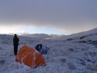
After a vicious hour long storm the ground was white. We decided to wait half an hour before leaving the tents for some exploration - just in case.
So we set off - climbed Carbineer's Point, but as we got near the top the mist came over again. I said to Hobbit that we may as well wait up here - after all, we had to reason to rush off the summit. In the interim I took some extreme closeup photos of the flowers on the peak. We built a summit cairn in the correct spot (the cairn was nowhere near the highest point of the summit) and sat in the mist. After about 20 mins we gave up and started heading down. As we hit the top of the pass again the mist cleared, so we shot back up the khulu and watched as the view cleared. WHAT A VIEW!
After watching clouds move around for half an hour, we headed off south to tackle Katana - we decided to leave Kambule till Saturday morning seeing as it is right next to the pass.
To reach Katana from Carbineer Point you have to follow the top of the Carbineer's Buttress (which is quite long), and then drop down a lot to reach the stretch of land that extends to the khulu. The khulu is surrounded by a large rock face that is only broken by one narrow, steep and slippery grass ledge with a few easy climbing moves (probably grade 5 or so). It isn't exposed.
Unfortunately there was mist over the top of the Long Wall and Giants - but the view north was incredible, and what we could see south was equally as impressive. It is really a worthwhile khulu!
Sitting on the top we heard lightning and looked straight into SA to see a large thunderstorm coming our way. So we dropped down off the peak, and contoured back, reaching the tents about 2km and half an hour later.
On getting to the tents it started to hail again. We could not have timed our expedition better!
While we were gone, Firephish was visited by plenty of locals - but fortunately, once again, we had a good night. Although we could hear dogs barking close to our tent throughout the night.
The following morning, myself and Hobbit khulu bagged Kambule. Once again there is only 1 spot to get up this khulu without technical climbing, and once again it was a peak with a standout view. While on top a large raptor (I am terrible at identifying birds, but I think it was a Lamagier) was circling just above us. These birds are such majestic creatures.
From there we dropped down South Jarding Pass - see the Jarateng Passes thread for details.
So at the end of this hike I am now down to 3 remaining passes at Giants (Corner, Thumb and North Jarding - 9/12 complete) and 8 remaining khulus (8/16 complete - 3/7 of the Carbineers done).
Ps. photos to follow shortly
Please Log in or Create an account to join the conversation.
Nearing the top of Langies pass
A short distance into Lesotho
The Langies river grows rather rapidly as you get into Lesotho
About 2km into Lesotho
The cave we noticed
Firephish fishing
The trail into Lesotho
The Langies river
A large peak in Lesotho at the confluence of the Langies and Jarateng rivers
The pool at the confluence
A cow by the pool
The Jarateng valley
Yet another twist in the Jarateng river
The Durnford ridge
Another large pool in Lesotho
Getting close to the escarpment
A lizzard
Looking back into Lesotho
Just before our camping spot. The peak in the centre is Carbineers Point
The view from our camping spot
Our camping spot from the top of the pass
The waterfall near our camping spot. It was barely visible when we got there, we could hear it after the storm.
After the hailstorm...
Flowers on top of Carbineers Point
The view north from Carbineers Point
The view south
Katana
Katana
Hobbit on top of Katana
Mount Durnford and North Jarding Pass from Kambule
The view south from Kambule
A friendly visitor circles overhead
Please login or register to view the images attached to this post.
Please Log in or Create an account to join the conversation.

Please Log in or Create an account to join the conversation.
On the tent-set up amongst the Kraals issue, I think its pretty hard to set up within 1 km of a kraal and not be seen, no matter how dark it is when you set up. Nothing much happens in those valleys and I'm sure the guys who live there don't miss anything that does. I might have been tempted to go and chat to them and ask them if it were OK to set up near them. This approach has several advantages - one being that you can sound them out and if they're aggro, move on, another is that there will be some sense of responsibility on the part of the locals for you if they are decent folk. Whenever I have done this, and not just in the Berg, it has worked out very well.
On another note, you guys were brave, given the history of the area, to bed down like you did. But it may be that the bad apples have moved on now. The area was troublesome since at least 1985. Perhaps those blokes have mellowed, moved in to town or picked one fight too many.
Please Log in or Create an account to join the conversation.

mnt_tiska wrote: Were there any fish on the fly?
Firephish can give you more accurate info - but if I am correct he caught 3 rainbow trout on day 1 and nothing on day 2. He does catch and release - I was looking forward to some trout for supper when I heard he brought fly fishing gear
mnt_tiska wrote: On the tent-set up amongst the Kraals issue, I think its pretty hard to set up within 1 km of a kraal and not be seen, no matter how dark it is when you set up. Nothing much happens in those valleys and I'm sure the guys who live there don't miss anything that does. I might have been tempted to go and chat to them and ask them if it were OK to set up near them. This approach has several advantages - one being that you can sound them out and if they're aggro, move on, another is that there will be some sense of responsibility on the part of the locals for you if they are decent folk. Whenever I have done this, and not just in the Berg, it has worked out very well.
They came and chatted to us on both nights. Firephish gave them cigarettes on both occasions (obviously different people though). Our thought was that 3 of them came to talk to 3 of us (and our group included a 12 year old, so they would have perceived that they had the edge on numbers if they had malicious intent) - they also had whips when they came to us. So if they really wanted to steal our stuff it would have been easier when we chatted to them as opposed to the night time attack approach.
As always though, they seemed friendly enough. One of them asked Michael for a fly - he gave him one.
On the second night the one guy even offered to let us stay in his kraal with him. Apparently he had meat and milk.
mnt_tiska wrote: On another note, you guys were brave, given the history of the area, to bed down like you did. But it may be that the bad apples have moved on now. The area was troublesome since at least 1985. Perhaps those blokes have mellowed, moved in to town or picked one fight too many.
There definitely is risk in camping in this valley - but I don't think its right to ever live in fear. I have a reputation of over-thinking things and being overly cautious, this was the bulk of the reason it took so many tries to finally bag Popple. In my mind I had been in both valleys on a few occasions and never had an issue. I am also not aware of anyone having issues in these valleys recently. I didn't see there being any more risk than camping close to the escarpment edge.
Admittedly though, I was half awake for most of the night - listening for noises etc.
Please Log in or Create an account to join the conversation.
