
Guess where?
Please Log in or Create an account to join the conversation.

Take nothing but litter, leave nothing but a cleaner Drakensberg.
Please Log in or Create an account to join the conversation.

")
My 200th post
")
Please login or register to view the image attached to this post.
Please Log in or Create an account to join the conversation.
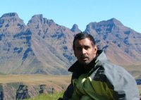
Please login or register to view the image attached to this post.
Please Log in or Create an account to join the conversation.
Andrew and I were doing a 6-day hike in the Southern Berg and our last day was from Sleeping Beauty Cave to Bushman's Nek. We were planning to go over the little berg ridge and drop into the valley to join up with the Giant's Cup Trail but the terrible weather (rain rain rain) had us hiking (swimming) down to Drakensberg Gardens and starting the Giant's Cup trail from there instead. In the thick mist, we didn't notice the fork a few km into the trail (who needs to navigate when on a hiking trail anyway?
 ) and only realised our error some 6km further East on the ridge above the Garden Castle valley - a gap in the mist revealed several trout dams which didn't seem right at all. Correcting this and increasing our pace big time, we finally got to the bridge in the photo above and slogged onwards through the rain and mist to Bushman's Nek for a 30-odd km day. Magan always uses this story as a counter to my chirps about him managing to turn Langalibalele Pass into a rock pass with some similarly stellar navigation!
Somewhat more flooded in this photo (Jan 2006):
Please login or register to view the image attached to this post.
Please Log in or Create an account to join the conversation.

Nice pic by Andrew. Compared to Popple's pics u can almost feel the force of the river in full flow and see the rain droplets on the grass.
Please Log in or Create an account to join the conversation.
@Megan: hey, don't bash my photo, its not my fault the river wasn't as flooded when i was there...
Please Log in or Create an account to join the conversation.
Yup:intrepid wrote: I stand under correction here, but I understand it means something to the effect of the Rock In/Of Shadows. Can anyone confirm?
Lefika = Rock
le = of
Moriti = shadows
Please Log in or Create an account to join the conversation.
- Smurfatefrog
-

- Away
- Moderator
-

- Posts: 1134
- Thank you received: 1551

Please login or register to view the image attached to this post.
Please Log in or Create an account to join the conversation.
- Serious tribe
-

- Offline
- Platinum Member
-

- Posts: 1057
- Thank you received: 778
Please login or register to view the image attached to this post.
Please Log in or Create an account to join the conversation.
