
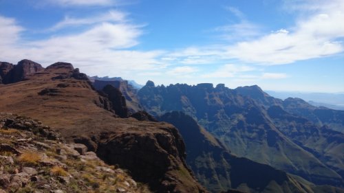
Tseketseke pass
Seems we're developing several threads on Tseketseke Pass, I did a write up on the thread, where both waterfalls are mentioned, with photos of each
Mod note: merged threads
Please Log in or Create an account to join the conversation.
- tonymarshall
-

- Offline
- VE Advisory
-

- Posts: 768
- Thank you received: 2233
tonymarshall wrote: I did a write up on the thread, where both waterfalls are mentioned, with photos of each:
I would normally read up all the writeups on a pass before doing it, especially a more difficult pass like Tseke. But our plan wasn't to do Tseke till the last minute, and I only joined the hike 11 hours before reaching the car park. I really wish I had been able to read that writeup before doing the pass.
I read as much about every Berg pass as I can, you never know when you will end up taking a pass you didn't plan on using - such as this weekend - but all I could remember about Tseke was the washaway, that there was a waterfall that required downclimbing and that Tseke Hut is an option for sleeping a large group.
I will have a proper read through your Tseke report again and see how our lines differed. Right now I need to focus on studying Fangs and Mbundini though

Please Log in or Create an account to join the conversation.

“Today is your day! Your mountain is waiting, So… get on your way!”
Please Log in or Create an account to join the conversation.

As the route planner, I take responsibility for not knowing as much as we could about Tseketseke Pass, even though it was out 'bale-out' route. A big lesson learned (amongst others), and thanks to ghaz, bartvandijk and Johan (not on VE yet) for guiding us through safely despite not being as well briefed as they would have liked. A detailed trip report to followBut our plan wasn't to do Tseke till the last minute, and I only joined the hike 11 hours before reaching the car park. I really wish I had been able to read that writeup before doing the pass.
")
Viking wrote:
I suspect not as we couldn't find straightforward ways around, more likely that the pictures were taken while descending having established that they were viable route options on the way up. I stand open to correction though.So Tony, did you bypass the waterfalls via the grass banks on the way up?
make a difference. today.
Please Log in or Create an account to join the conversation.
I have some pictures of the route that I will try to attach and I can send a GPX file for that section if you need it.
Please Log in or Create an account to join the conversation.

Please login or register to view the images attached to this post.
Please Log in or Create an account to join the conversation.
Last year on the VE Berg Trip, intrepid and I came down the waterfall section and downclimbed both waterfalls; I got these shots of intrepid descending after I had already downclimbed each of the waterfalls.
This is the upstream waterfall, where you climb in the water.
This one is going to be a big headache with a few more years of erosion.
The downstream waterfall can be bypassed on the true right by using a rock slope with good hand and footholds,
and then traversing across next the pool at the base of the waterfall on a narrow ledge.
Do these waterfalls still look the same, or have they got worse?
Please login or register to view the images attached to this post.
Please Log in or Create an account to join the conversation.
- tonymarshall
-
- Offline
- VE Advisory
-
- Posts: 768
- Thank you received: 2233
I don't recognise the second waterfall - it could be that I only saw it from above (sadly I didn't get a photo), but what I remember was higher, had a lot of water going over it and a big pool below. We tried to bypass the large waterfall by a trail on the true left bank, but the trail had been washed away, so it took us to a big drop, forcing us to backtrack, and eventually take a much higher (and dangerous feeling) loose grass bank - higher than the trail - I hoped to find the usual grass ledges high up, but there wasn't one this time. I find that it is safer to go higher as you have more time to react if you fall, and it is usually less steep higher up. It is possible that we missed the waterfall in your photo as we missed about 200m of the riverbed when traversing the ledge, and that you found a way around the waterfall that stumped us, but we either didn't notice the route around, or it is no longer there.
I don't think this pass has a great future, unless someone can find a route around the middle section, or the collapsing of the rocks around the waterfalls has the effect of making them more passable.
It is really just those 2 obstacles that make the pass difficult - the rest of the pass is pretty straightforward. Just stay in the riverbed till about 2650m, then find the trail on the true right bank and follow it to the top - not that complicated...
Here is the spot where we were forced off the trail into the riverbed (with the trail leading to a washaway)
Here's AndrewR helping with the lowering of packs to the side of the waterfall, while the rest of the team downclimbs the waterfall (out of frame)
Ps. I rate you could probably climb up or down by where we lowered packs, but from above this is not obvious.
Please login or register to view the images attached to this post.
Please Log in or Create an account to join the conversation.
Please Log in or Create an account to join the conversation.
Please Log in or Create an account to join the conversation.
- tonymarshall
-
- Offline
- VE Advisory
-
- Posts: 768
- Thank you received: 2233
