
Injisuthi Pass
14 Sep 2014 07:27 #61797
by elinda
Replied by elinda on topic Injisuthi Pass
Thanks for the great write up and photos Dillon, I thoroughly enjoyed your adventure. What was the water situation like up the Pass? It looked pretty dry and I am guessing that you had to carry sufficient for your needs? Loved the video too, well done!
Please Log in or Create an account to join the conversation.
14 Sep 2014 10:48 #61798
by Dillon
Replied by Dillon on topic Injisuthi Pass
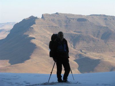
The water situation was surprisingly good, or I should actually say, I expected it to be worse. We filled up at the bottom of Leslie's Pass, thinking that would be the last water we would have, but as we ascended there seemed to be places along the way where the stream was still flowing. I didn't measure exactly, but if I had to guess, I'd say the last water was available maybe just within 1km from the summit.
The river on the Lesotho side of Leslie's Pass summit appeared (from a distance) to be flowing.
The river on the Lesotho side of Leslie's Pass summit appeared (from a distance) to be flowing.
The following user(s) said Thank You: elinda
Please Log in or Create an account to join the conversation.

15 Sep 2014 03:28 #61799
by Serious tribe
Replied by Serious tribe on topic Injisuthi Pass
Made my day as well...big time!!! 
Please Log in or Create an account to join the conversation.
- Serious tribe
-

- Offline
- Platinum Member
-

Less
More
- Posts: 1064
- Thank you received: 782
16 Sep 2014 12:09 #61820
by LouisvV
Replied by LouisvV on topic Injisuthi Pass
Awesome video!
Please Log in or Create an account to join the conversation.

03 May 2017 14:53 #71472
by Riaang
Replied by Riaang on topic Chockstone at the top of Injasuthi pass
While on our annual family hike from Injasuthi camp to Leslies pass and then accross the escarpment edge towards UIC we stopped at the top of Injasuthi pass for lunch. Last time I was there was probably 3 years ago and I don't recall remembering a chockstone at the top of the pass head. I distinctly remember looking down the pass and could see the steep chimney. Now the view was blocked by the chockstone. Is this a recent development?
Please login or register to view the image attached to this post.
Please Log in or Create an account to join the conversation.
03 May 2017 15:10 #71473
by Dillon
Replied by Dillon on topic Chockstone at the top of Injasuthi pass
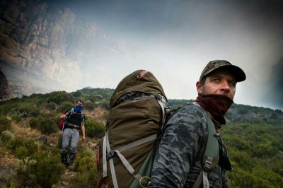
I'm not sure you've got the right pass there. The top of the pass looks like this:
Dillon wrote:
The following user(s) said Thank You: anthony
Please Log in or Create an account to join the conversation.
10 May 2017 14:42 #71550
by ghaznavid
Replied by ghaznavid on topic Injisuthi Pass
How high is the scramble at the top?
In Intrepid's photo it looks around 5m. Just want to be sure my 20m rope would be adequate.
In Intrepid's photo it looks around 5m. Just want to be sure my 20m rope would be adequate.
Please Log in or Create an account to join the conversation.

10 May 2017 15:10 #71551
by Dillon
Replied by Dillon on topic Injisuthi Pass
It's definitely higher than 5m. We used a 30m rope and that was long enough to use the excess to set up an adequately protected stance around a big boulder at the top for the belayer. The climbing is pretty easy though.
Please Log in or Create an account to join the conversation.
06 Jul 2017 19:38 #71831
by biomech
Replied by biomech on topic Injisuthi Pass
On 16 June 2017, Ghaznavid and I set off on a hike starting from the hiker’s parking at the Injisuthi Camp. Our plan for the trip was to ascend Injisuthi Pass and then do some recce on what I will call “the mythical version of Hilton Pass” and arrive back at camp in time for me to spend Father’s Day with my family (who were staying at Injisuthi) on 18 June, so basically a 44km overnight hike. A quick word about Hilton Pass: The mythical one is the one that is not marked on the maps but that is described in Bill Barnes’ book “Giants Castle”, stating that the pass goes between the two Injisuthi Buttresses. Barnes gave it the name Hilton Pass due to the fact that a number of Hilton schoolboys were along for the trip. The marked pass goes in a gully between the Lesser Injisuthi Buttress and the Red Wall and is a route well documented on this website (complete with rather hairy photos).
Photographic evidence of the escarpment edge between the two Buttresses from the top is scarce and all available shots from below were inconclusive as to whether there may be a way up there that is as Barnes described in his book or not. Photos from both Barnes’ book and in other sources, not least of which being VE’s own Richard Hunt’s stunning pictures of the area, were reviewed. The remainder of our plan was to descend the marked Hilton Pass if it was safe to do so, or, if all else failed traverse across to Leslie’s Pass to descend. As is customary for Ghaz and my hikes together, we were planning on doing routes that are not in the “most done Berg routes” category and therefore we were surely in for some fun!
We set off just after 4am with the aim of getting to Marble Baths before sunrise. It was misty with the occasional drizzle, which made us wonder whether it was already snowing at higher altitudes. We arrived at Marble Baths around 6:30am and stopped for a bite to eat. We had figured that the route from there to the split off to Leslie’s Pass would take a further 2h30 which would give us a good run at the pass (via Buttress Fork) before nightfall. The route to the Leslie’s split was a combination of trails with cairns and rock hopping in the river. It went fairly smoothly, albeit a bit slower than what we could have done it at, if we had followed the Leslie’s trail all the way and we passed the split just after 9am. There was a wonderful moment in this section when the mist cleared and we briefly saw the Dragon illuminated in all its glory in the morning sun. It was an incredible sight. This was heightened by the anticipation for the remainder of the day when we saw the full extent of the climb to come!
This pic show the brief view we got of The Molar
The approach to the base of the pass is quite scrambly, with a number of large boulders to navigate in the riverbed. We didn’t find this to be too difficult, taking some time to do proper route-finding. However, as a precaution we decided to put our helmets on in order to protect ourselves if we fell.
Ghaz and I engaged in a great number of highly interesting conversations which spanned global politics, economics, medical technology and a critique of corporate-sponsored science. This made the time and distance pass very quickly, despite a few challenging moments. At the 2500m point there came a large split in the gully, with the option to continue in the large gully or enter a second one coming down from the true right by ascending some boulders with a waterfall coming down over them. In the other gully was a clear 50m vertical of boulder climbing which looked like it didn’t pose too many problems. As such, we opted to continue in the gully on the true left. This was a departure from the track we were following (Intrepid’s). We reached the base of the pass, probably at around 2500m or so at 11:30am. Water had been flowing steadily in the gully and continued to do so up until 2600m or thereabouts in our gully.
The walk up the first part of the pass is pretty much sustained boulder hopping, boulder climbing and the odd traverse out of the gully to avoid tricky bits. There is a large amount of fynbos quite high up in this area, which provides the double-edged sword of being great to hold on to when on steelply angled slopes dropping off into a rock gully, but also being incredibly tough to get through at the same time.
All this stopping and starting allowed us to take in the amazing views of Scaly Peak and the Greater Injisuthi Buttress from an uncommon angle. Eventually, we realized that we would need to traverse into the main gully (the one we had opted not to get into earlier at the waterfall) and spotted a slope to climb over the ridge. This involved more wading through head-high fynbos. We arrived in the main gully at approximately 2850m, with another 350m vertical to go over a distance of under 900m horizontal according to Intrepid’s track. This section was pretty simple steep grass, with a few scrambles here and there. When the track was showing 250m vertical over 450m horizontal, we knew that the crux of the pass was approaching.
The view up the gully was starting to get pretty spectacular, with the cliffs closing around us. We were above the clouds and the views back from the way we came were breathtaking. We noticed a very interesting, large overhanging piece of basalt cliff that is uncommon in the high Berg. We also saw a few “good” bivvy caves if things didn’t go well further up. We passed the odd snow ice patch and even discovered the partially decomposed carcass of a hunting dog.
The crux of the route is something that we had researched to the best of our ability and had thus brought along with us a full trad rack with 50m of rope. This had added a good 4kg to our combined weight, which, along with overnight necessities had fatigued us greatly on the way up. Rounding a slight left bend in the pass and ascending further scrambles we arrived at the base of the crux at approximately 3100m. The beginning section was covered in two distinct patches of compacted snow ice. Luckily the ice didn’t impede us starting the climb.
I’m going to add a few comments here to make sure that anyone who reads this writeup is certain of our opinion of the route. This final section of Injisuthi Pass is a proper technical climb on bad quality rock with very poor gear placements or anchors. It is probably 25 - 35m of climbing from the very bottom of the section, comprised of shorter sections of no more than 5m each. The problem really is that there is very little protection on the route and large quantities of rock were sent down the gully with holds breaking off on every part of the climb. This characteristic is especially dangerous in larger groups. The danger of falling on this section is very real and the probability of this happening most likely means that doing it is beyond what most people would consider “acceptable risk”. The very vast majority of people who begin this climb will not be able to safely down-climb it. As such, committing to the route means that you have to finish it. The hardest sequence is about halfway up, where the biggest chunks of rock were sent down the gully by Ghaz, after I had used the holds. These pieces of rock did not stop rolling (audibly) for quite a while, giving us an idea of how far we could also travel downwards if we fell. The hardest move requires pushing your left foot against the true right cliff while leaning against the true left cliff and wiggling your way up before awkwardly turning around and pulling on some grass. Not everyone’s cup of tea. The difficulty of the section was compounded by our long day of 12 hours and 1800m vertical before we began the climb.
Personally, I don’t believe that this route could be conceived of as a hiking route by the average hiker. It should probably not be on the EKZNW maps as a route. If you are not comfortable on rock or skilled in intermediate climbing techniques and ropework, it is best avoided! This concern is made more real by the fact that a number of the holds we did use are no longer available to the next group who makes the attempt.
It took us approximately 1h30 to complete the climb, recollect our thoughts and then hit the final 50m via the gully to the top. We reached the top just after sunset to great elation and relief. We had about 2km to go and we motored down across the valley to the cave we were planning on sleeping in, which is situated about 20m down the marked Hilton Pass. Ghaz found it expertly in the gathering dark! We reached the cave just after last light and had to navigate a frozen drip situated next to the cave. Luckily our water was still liquid as we had refilled in the stream coming down from Mafadi on the way to the cave. All in all, it was a great day’s hiking. We took 14 hours to do 22km, which gives you an idea of the terrain and elevation!
As we reached the cave an icy Berg wind, that would persist for the rest of the trip, came up and we hurriedly climbed into our sleeping bags to warm up whilst trying to sort out some form of dinner. The night was one of the windiest I have experienced on the escarpment, made worse by the lack of a cave wall. Basically, the entire night was spent with just our upper torsos protected from the wind! This was a time when good gear (in this case it was our Mountain Hardware Lamina 20 sleeping bags) working the way it should makes you really feel the love for the manufacturers.
Photographic evidence of the escarpment edge between the two Buttresses from the top is scarce and all available shots from below were inconclusive as to whether there may be a way up there that is as Barnes described in his book or not. Photos from both Barnes’ book and in other sources, not least of which being VE’s own Richard Hunt’s stunning pictures of the area, were reviewed. The remainder of our plan was to descend the marked Hilton Pass if it was safe to do so, or, if all else failed traverse across to Leslie’s Pass to descend. As is customary for Ghaz and my hikes together, we were planning on doing routes that are not in the “most done Berg routes” category and therefore we were surely in for some fun!
We set off just after 4am with the aim of getting to Marble Baths before sunrise. It was misty with the occasional drizzle, which made us wonder whether it was already snowing at higher altitudes. We arrived at Marble Baths around 6:30am and stopped for a bite to eat. We had figured that the route from there to the split off to Leslie’s Pass would take a further 2h30 which would give us a good run at the pass (via Buttress Fork) before nightfall. The route to the Leslie’s split was a combination of trails with cairns and rock hopping in the river. It went fairly smoothly, albeit a bit slower than what we could have done it at, if we had followed the Leslie’s trail all the way and we passed the split just after 9am. There was a wonderful moment in this section when the mist cleared and we briefly saw the Dragon illuminated in all its glory in the morning sun. It was an incredible sight. This was heightened by the anticipation for the remainder of the day when we saw the full extent of the climb to come!
This pic show the brief view we got of The Molar
The approach to the base of the pass is quite scrambly, with a number of large boulders to navigate in the riverbed. We didn’t find this to be too difficult, taking some time to do proper route-finding. However, as a precaution we decided to put our helmets on in order to protect ourselves if we fell.
Ghaz and I engaged in a great number of highly interesting conversations which spanned global politics, economics, medical technology and a critique of corporate-sponsored science. This made the time and distance pass very quickly, despite a few challenging moments. At the 2500m point there came a large split in the gully, with the option to continue in the large gully or enter a second one coming down from the true right by ascending some boulders with a waterfall coming down over them. In the other gully was a clear 50m vertical of boulder climbing which looked like it didn’t pose too many problems. As such, we opted to continue in the gully on the true left. This was a departure from the track we were following (Intrepid’s). We reached the base of the pass, probably at around 2500m or so at 11:30am. Water had been flowing steadily in the gully and continued to do so up until 2600m or thereabouts in our gully.
The walk up the first part of the pass is pretty much sustained boulder hopping, boulder climbing and the odd traverse out of the gully to avoid tricky bits. There is a large amount of fynbos quite high up in this area, which provides the double-edged sword of being great to hold on to when on steelply angled slopes dropping off into a rock gully, but also being incredibly tough to get through at the same time.
All this stopping and starting allowed us to take in the amazing views of Scaly Peak and the Greater Injisuthi Buttress from an uncommon angle. Eventually, we realized that we would need to traverse into the main gully (the one we had opted not to get into earlier at the waterfall) and spotted a slope to climb over the ridge. This involved more wading through head-high fynbos. We arrived in the main gully at approximately 2850m, with another 350m vertical to go over a distance of under 900m horizontal according to Intrepid’s track. This section was pretty simple steep grass, with a few scrambles here and there. When the track was showing 250m vertical over 450m horizontal, we knew that the crux of the pass was approaching.
The view up the gully was starting to get pretty spectacular, with the cliffs closing around us. We were above the clouds and the views back from the way we came were breathtaking. We noticed a very interesting, large overhanging piece of basalt cliff that is uncommon in the high Berg. We also saw a few “good” bivvy caves if things didn’t go well further up. We passed the odd snow ice patch and even discovered the partially decomposed carcass of a hunting dog.
The crux of the route is something that we had researched to the best of our ability and had thus brought along with us a full trad rack with 50m of rope. This had added a good 4kg to our combined weight, which, along with overnight necessities had fatigued us greatly on the way up. Rounding a slight left bend in the pass and ascending further scrambles we arrived at the base of the crux at approximately 3100m. The beginning section was covered in two distinct patches of compacted snow ice. Luckily the ice didn’t impede us starting the climb.
I’m going to add a few comments here to make sure that anyone who reads this writeup is certain of our opinion of the route. This final section of Injisuthi Pass is a proper technical climb on bad quality rock with very poor gear placements or anchors. It is probably 25 - 35m of climbing from the very bottom of the section, comprised of shorter sections of no more than 5m each. The problem really is that there is very little protection on the route and large quantities of rock were sent down the gully with holds breaking off on every part of the climb. This characteristic is especially dangerous in larger groups. The danger of falling on this section is very real and the probability of this happening most likely means that doing it is beyond what most people would consider “acceptable risk”. The very vast majority of people who begin this climb will not be able to safely down-climb it. As such, committing to the route means that you have to finish it. The hardest sequence is about halfway up, where the biggest chunks of rock were sent down the gully by Ghaz, after I had used the holds. These pieces of rock did not stop rolling (audibly) for quite a while, giving us an idea of how far we could also travel downwards if we fell. The hardest move requires pushing your left foot against the true right cliff while leaning against the true left cliff and wiggling your way up before awkwardly turning around and pulling on some grass. Not everyone’s cup of tea. The difficulty of the section was compounded by our long day of 12 hours and 1800m vertical before we began the climb.
Personally, I don’t believe that this route could be conceived of as a hiking route by the average hiker. It should probably not be on the EKZNW maps as a route. If you are not comfortable on rock or skilled in intermediate climbing techniques and ropework, it is best avoided! This concern is made more real by the fact that a number of the holds we did use are no longer available to the next group who makes the attempt.
It took us approximately 1h30 to complete the climb, recollect our thoughts and then hit the final 50m via the gully to the top. We reached the top just after sunset to great elation and relief. We had about 2km to go and we motored down across the valley to the cave we were planning on sleeping in, which is situated about 20m down the marked Hilton Pass. Ghaz found it expertly in the gathering dark! We reached the cave just after last light and had to navigate a frozen drip situated next to the cave. Luckily our water was still liquid as we had refilled in the stream coming down from Mafadi on the way to the cave. All in all, it was a great day’s hiking. We took 14 hours to do 22km, which gives you an idea of the terrain and elevation!
As we reached the cave an icy Berg wind, that would persist for the rest of the trip, came up and we hurriedly climbed into our sleeping bags to warm up whilst trying to sort out some form of dinner. The night was one of the windiest I have experienced on the escarpment, made worse by the lack of a cave wall. Basically, the entire night was spent with just our upper torsos protected from the wind! This was a time when good gear (in this case it was our Mountain Hardware Lamina 20 sleeping bags) working the way it should makes you really feel the love for the manufacturers.
Please login or register to view the images attached to this post.
The following user(s) said Thank You: Andreas
Please Log in or Create an account to join the conversation.
06 Jul 2017 19:42 #71832
by biomech
Replied by biomech on topic Injisuthi Pass
The following day, the wind was still gusting at incredible speeds. We stayed in our sleeping bags until the sun was well and truly up to keep warm. The wind chill was very unpleasant and we had frozen hands, through our gloves, in a very short space of time after starting to pack up. We decided that our Injisuthi Buttress / mythical Hilton Pass recce mission would have to wait as it was just too dangerous to go too close to the escarpment edge to look at routes that may not even be there! In addition, we also decided that it would be unsafe to descend the marked Hilton Pass as the route-finding required may be made more difficult by the wind. Our research on the route had also shown that steep grass slopes would be involved. We were not keen in that wind!
Breakfast was at the bottom of the valley between Hilton Pass and Injisuthi Pass utilizing a rock as a wind-break. The river coming down from Mafadi that heads over the escarpment next to the Greater Injisuthi Buttress was partially frozen, highlighting the rather chilly temperature. At around 9am, we made our way across the escarpment to Leslies Pass, which was about 7 or 8km away. We headed down Leslie’s Pass in an absolute gale which blew us off our feet on a number of occasions. Once we had descended the pass we found our way onto a very well worn path on the terrace on the true left of the river. This cut a large amount of time out of our journey and we eventually made it back to the Injisuthi camp just after 4pm.
Breakfast was at the bottom of the valley between Hilton Pass and Injisuthi Pass utilizing a rock as a wind-break. The river coming down from Mafadi that heads over the escarpment next to the Greater Injisuthi Buttress was partially frozen, highlighting the rather chilly temperature. At around 9am, we made our way across the escarpment to Leslies Pass, which was about 7 or 8km away. We headed down Leslie’s Pass in an absolute gale which blew us off our feet on a number of occasions. Once we had descended the pass we found our way onto a very well worn path on the terrace on the true left of the river. This cut a large amount of time out of our journey and we eventually made it back to the Injisuthi camp just after 4pm.
Please login or register to view the images attached to this post.
The following user(s) said Thank You: elinda, Stijn, JonWells, jamcligeo, ghaznavid, tonymarshall, Redshift3, Andreas, Coeta, GriffBaker
Please Log in or Create an account to join the conversation.
