Transport in and around the Drakensberg

Aside from a resupply, transport is easily the hardest part of a GT to plan. My advice is to find a hiker who is heading that way and is happy to help you with a lift. How many people will you have in your team?
You can catch a Greyhound or Intercape bus from Durban to Harrismith, and then arrange for Witsieshoek to send a vehicle to pick you up there. Neither is cheap, but it will get you there. As you say, try Underberg Express for transport from Bushman's Nek.
A GT is a tricky hike to do off just a GPS track. I have done 2 GTs in the last 3 months and the drought has been hitting Lesotho hard. In October water will be low, so you will need to know where to look for it. The Berg can also surprise you, it isn't the easiest mountain range in the world - don't underestimate the Dragon!
There is a large amount of info on the GT on this site - I have personally done 4 GTs with writeups and photos on all 4, Tony Marshall has also done a writeup on one of his, and I seem to recall Sabine also doing one as well. If you would like links, let me know.
Please Log in or Create an account to join the conversation.

Thanks for your reply. We'll be 3 I think ...
For the resupply of water, what would be the best month? Personnally I have choosen the month of october because of the spring, the flowers and thus the botanical topic. I have learn here the problem of this exceptional drought.
You said "GT is a tricky hike to do off just a GPS track". I understand and agree, but what do you mean exactly? Is it tough because of the weight of the backpack and the watering, because it is always 3000m above sea level? (We are merely seniors but trained). Is an adaptation period necessary or compulsory ? Or anything else ?
I have just received the good knzwildlife 25k maps and I have 2 GPS tracks. Is the trail well marked and readable in the "fields" ?
Please Log in or Create an account to join the conversation.

It is hard to predict how this drought will follow through - some reports say they are expecting the rain to start picking up around October this year, others say this drought will last another 10 years. October is usually a good month for a GT, it just really depends on whether or not the rain does in fact pick up by then. September is often the worst for rivers, as it is the end of the dry months. But that all depends on how much rain/snow fell in winter.mayake wrote: For the resupply of water, what would be the best month? Personnally I have choosen the month of october because of the spring, the flowers and thus the botanical topic. I have learn here the problem of this exceptional drought.
I did a GT in November 2015 and water was mostly ok, but not abundant. It was actually worse in some places on my December GT.
Excuse the vague answer - what I am getting at is that it is hard to predict, but usually by November there is water.
A GT has a lot of different difficulties. They include:mayake wrote: You said "GT is a tricky hike to do off just a GPS track". I understand and agree, but what do you mean exactly? Is it tough because of the weight of the backpack and the watering, because it is always 3000m above sea level? (We are merely seniors but trained). Is an adaptation period necessary or compulsory ? Or anything else ?
- Pack weight is an issue if you aren't used to carrying 20+kg for consecutive days
- Sustained long days, on a standard 12 day GT, your days will range from 15 to 25km per day, with about 1km in altitude gain and loss each day. With a heavy pack, this can be difficult
- Drakensberg weather changes quickly and dramatically. You can go from a boiling hot day to being in a massive thunderstorm in a very short space of time. Mist and wind team up to make a very cold combo - on my recent GT, my fellow team member had hypothermia one day - and that was in the middle of summer!
- Navigation can be tricky. A GPS is great, but they can fail. If you don't know your way around the 30 valleys a GT goes through, you can get into a spot of bother. The only 2 cliffs you have to worry about are Durnford Gap and Ntonjelana Gap, both of which are easy if you know where to look - Ntonjelana Gap also has a trail from below and above. There are alternative lines if you can't find Durnford Gap, but Durnford Gap is probably the easiest route. In clear weather you can try to navigate by keeping an eye on the edge of the escarpment, but that is tricky and not always possible. It also doesn't account for mist. You should have at least 1 GPS track (there is one in the downloads section), but once again, there must be 30 different major variations one can take on a GT - the speed route and the route I used on my December GT probably share less than 50% and differ in distance by around 70km.
- A GT is very long, so you need to be prepared for the fact that some days won't be that enjoyable, usually due to poor weather.
- Dogs! They are usually easy to chase off by throwing rocks at them, but I have had some rather massive dogs be less than friendly to me up there, and it can get scary at times!
- Knowing how to handle the locals. Don't get me wrong, 99% of Basothos are genuinely great people. But they have a very different culture to Western Culture. I have personally never been on the wrong end of a personal attack from a Basotho, and only once ever had my things stolen (a pair of gloves). When people are aggressive towards them, that is often when you have problems happen. Then again, there was the gunshot incident on New Years Day and a group was held up and robbed last year on a pass.
In a normal year, water wouldn't be a problem - but as I say, this drought has been devastating. It really depends on whether or not it ends by then. Altitude on a GT is rarely a problem, but if you have never been to 3000m before, it could be an issue.
Remember that there is no trail for a GT. Admittedly a GT usually includes the Mnweni Cutback Highway (by highway I mean a well defined trail), the Yodeler's/Nkosasana Highway and even the Lithabeneng/Redi trail - but these are all trails that you follow for a distance, and then often have to turn off at unmarked seemingly arbitrary point.mayake wrote: I have just received the good knzwildlife 25k maps and I have 2 GPS tracks. Is the trail well marked and readable in the "fields" ?
Don't let me put you off doing a GT - it is an amazing hike, I have personally done it 4 times and am seriously considering doing it again this December - just don't underestimate the difficulty of the route.
Please Log in or Create an account to join the conversation.
I'll not forget "just don't underestimate the difficulty of the route" and we will prepare this GT the best we could.
Please Log in or Create an account to join the conversation.
mayake wrote: I'll not forget "just don't underestimate the difficulty of the route" and we will prepare this GT the best we could.
If you are interested, here are links to my 4 GT writeups:
www.vertical-endeavour.com/forum/16-drakensberg-grand-traverse/53719-the-upside-down-dragon-gt2012.html
www.vertical-endeavour.com/forum/drakensberg-trips/55708-gt2014-15-don-t-follow-the-lights.html?limitstart=0
www.vertical-endeavour.com/forum/16-drakensberg-grand-traverse/55945-5-day-gt-%E2%80%93-a-walk-in-the-park-ghaz-andrew-s-gt.html?limitstart=0
www.vertical-endeavour.com/forum/drakensberg-trips/55970-gt2015-2016-climb-every-mountain.html?limitstart=0
In total that is close to 100 pages of reading, so I doubt you will read that much of it, but it has a lot photos and route info.
On each GT there were parts of the route that always differed and other parts that were always the same. For example, I have used a different line between the Chain Ladders and Rat Hole Cave on all 4 of them, yet all 4 used the same line from below Yodelers Peak to below Nkosasana Peak. One thing I love about a GT is that you can do so many different lines through most of the valleys. You really can't exhaust the varieties!
Please Log in or Create an account to join the conversation.
The trails in Spain are *much* better marked. If you are a first time walker in the 'berg you will want GPS tracks and/or map-reading skills (+ maps).
The above is not meant to put you off, but to encourage - from a previous post I read that you have already got the maps, so go for it!
(NB: I have not done a GT)
Please Log in or Create an account to join the conversation.

The ZAR/GBP is really favourable to you right now, why not start planningjumbleoak wrote: (NB: I have not done a GT)
Please Log in or Create an account to join the conversation.
jumbleoakAs you have already hiked in Europe, you can go and see my blog where I have reported some of my last treks, for exemple the last one in south balkans (albania-kosovo-montenegro) dinaric alps mountains are stunning there. But unfortunatly, it is in French

Please Log in or Create an account to join the conversation.
ghaznavid wrote: that is close to 100 pages of reading, so I doubt you will read that much of it, but it has a lot photos and route info.
do not worry, I have plenty of free time
Please Log in or Create an account to join the conversation.
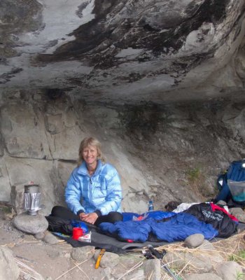
By the way, there are no huts on the route and no way to resupply, unless you organise it.
Please Log in or Create an account to join the conversation.